Potomac River Mainstem
Interstate Commission on the Potomac River Basin
Fourth Largest River on the East Coast
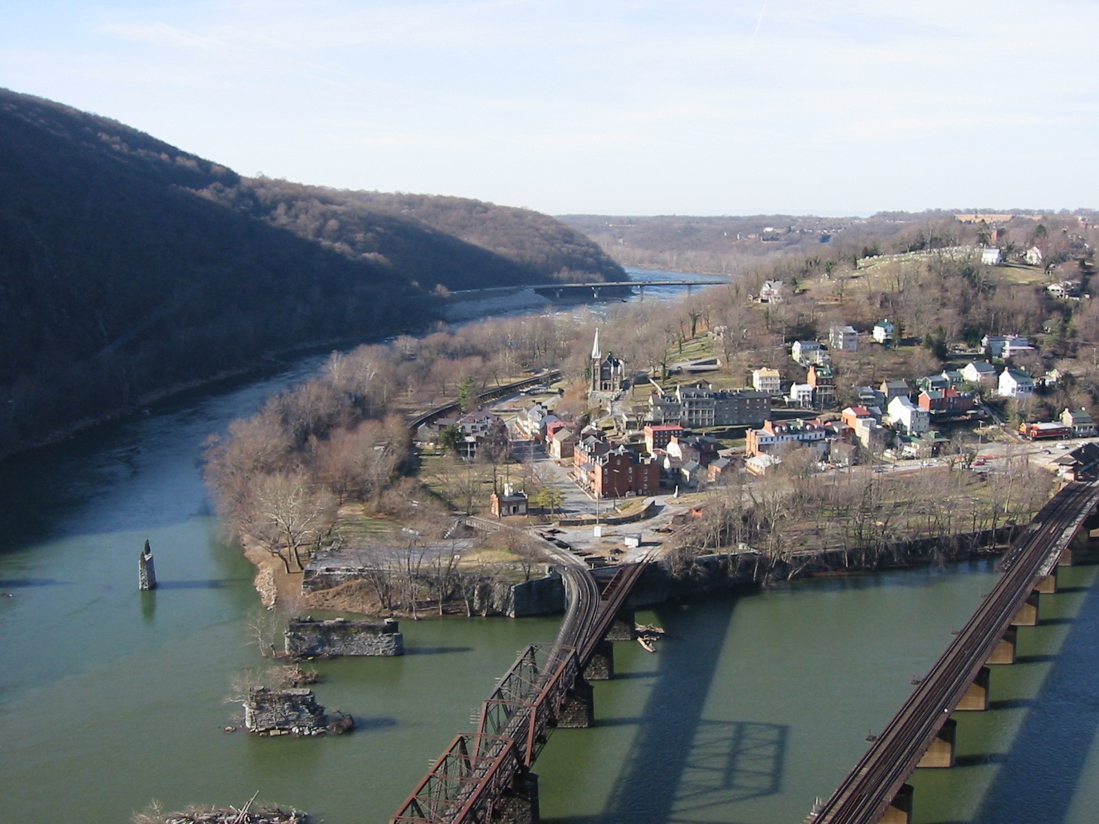
Confluence of the Potomac and the Shenandoah rivers.
Stretching from the confluence of the North Branch and South Branch rivers to the tidal estuary, the free-flowing Potomac mainstem is sometimes wadeable but its boulder-strewn bottom and changeable currents can make the river difficult to sample.
A minimum flow-by of 100 million gallons per day at Little Falls, just upstream of tidal waters, is observed by jurisdictions withdrawing water from the mainstem for the Washington D. C. metropolitan area.
- Lower Potomac Mainstem Biological Survey: Surveys of macroinvertebrate and freshwater mussel populations in the Potomac mainstem, 2009 – 2014.
- Potomac Large River Environmental Flow Needs: The report identifies the hydrologic needs of flow-dependent species and communities in four segments of the mainstem Potomac and two selected large tributaries using a modification of the Ecologically Sustainable Water Management approach described in Richter et al. (2006). The project’s associated workshop and this report were part of a broader Middle Potomac River Watershed Assessment effort to identify, protect, and, where necessary, restore the Potomac watershed’s environmental flows.

Lower Potomac Mainstem Biological Surveys
 These studies documented the status of freshwater mussels and macroinvertebrates in the lower Potomac River mainstem between 2009 and 2014. The results provide a baseline for evaluating the potential impacts of water withdrawals and flow modifications in the Great Falls and Little Falls sections of the river during severe drought. The project augments state-wide monitoring programs in Maryland and Virginia.
Freshwater Mussel Surveys at Dam #5, Paw Paw Bends, and Mason Island, 2009 – 2012
The objectives of this mussel survey were:
- Augment biological information collected at several study reaches established in the Potomac River’s mainstem;
- Improve our understanding of the status of Potomac River mussel species, their temporal variation and trends, relationship to the river’s general health, and;
- Help evaluate how mussel communities in typical sections of the river compare with sections potentially impacted by pollution or altered flows, especially where low-flows are exacerbated by consumptive water uses.
Qualitative habitat mapping and identification of mussel beds were completed in 2009. Quantitative in-situ surveys of mussel abundance were done in three river reaches: just downstream of Dam #5 near Williamsport, Maryland (2010), in the Paw Paw Bends region upstream of Fifteen Mile Creek in Alleghany County, MD (2011, 2012), and around Mason Island upstream of Whites Ferry crossing in Montgomery County, MD (2011, 2012). Parameters measured included species richness, relative abundance, recruitment, and presence of any state or federally rare, threatened or endangered mussels.
Progress Reports
- Freshwater Mussel Survey of the Potomac Mainstem, 2012 Summary Report (ICPRB Report 12-9)
- 2011 Freshwater Mussel Survey of the Potomac Mainstem (ICPRB Report 11-5)
- 2010 Freshwater Mussel Survey of the Potomac Mainstem (ICPRB Report 10-7)
Biological Surveys at Knoxville, Carderock, and Little Falls, 2012 – 2014
Surveys of freshwater mussel and benthic macroinvertebrate populations were conducted during late-summer low-flow periods of 2012, 2013, and 2014 at three mainstem sites: 1) near Knoxville, Maryland; 2) Great Falls, near Difficult Run; and 3) Little Falls, downstream of the Brookmont Dam. These years had moderate flows overall and did not experience extreme drought or floods, so managers and researchers should view the results as a characterization of biological communities unaffected by flow extremes. These reaches were selected because they are difficult to sample and represent gaps in spatial coverage of the mainstem in the otherwise comprehensive Maryland Department of Natural Resources Core Trend Monitoring Program.
Data from the Knoxville reach will improve our understanding of the mixing zones below the confluence of the Shenandoah and Potomac rivers and the relative importance of each river at the Potomac water supply intakes downstream. The Carderock and Little Falls reaches are important in identifying stresses on the river’s biological communities that could relate to upstream consumptive losses and water supply withdrawals during severe droughts. The Little Falls reach is in the only stretch of the Potomac River with a minimum flow-by requirement.
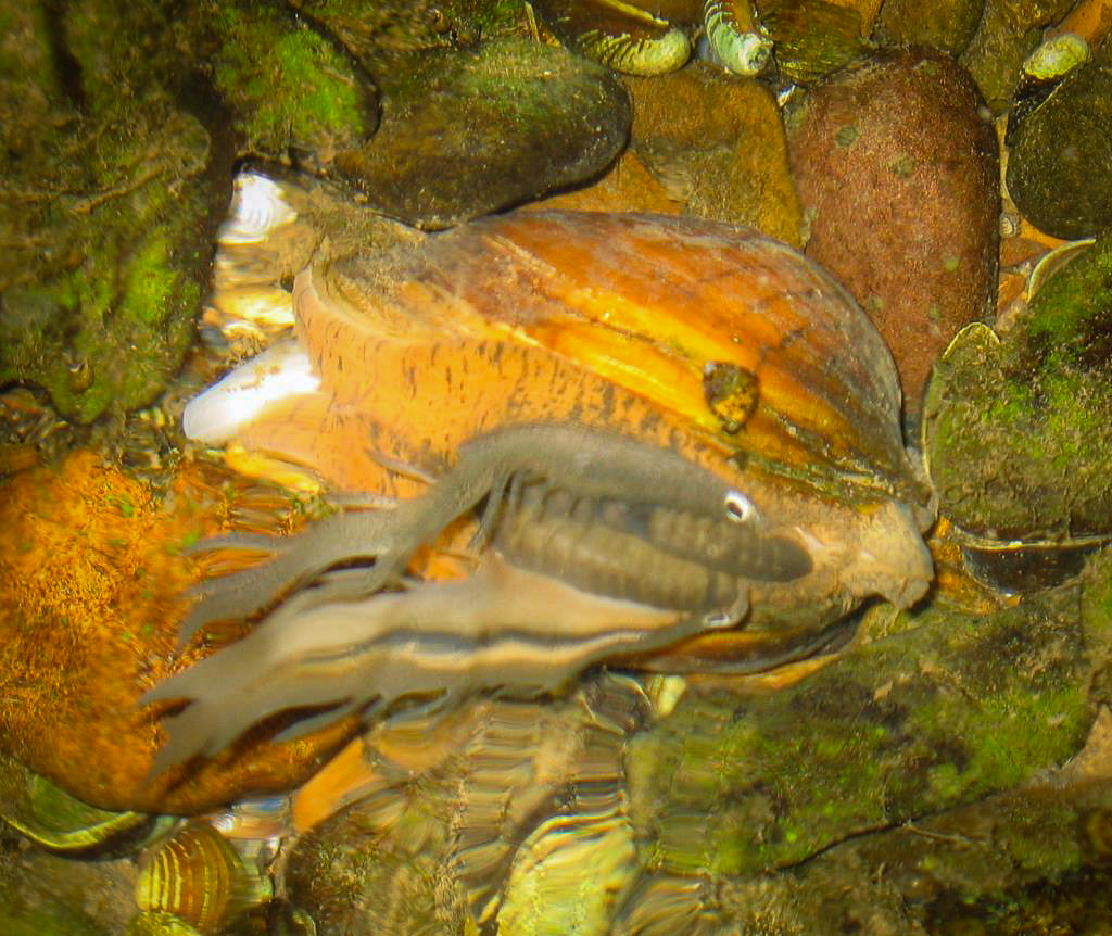
Freshwater mussels
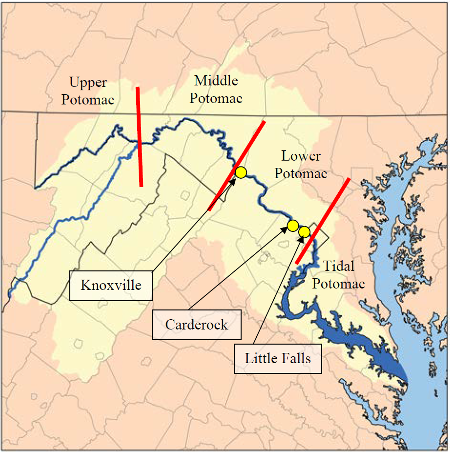
Study locations on the Potomac River mainstem. The Potomac Basin (light yellow) with segments indicated: Upper Potomac, Middle Potomac, Lower Potomac, and Tidal Potomac.
Collections yielded 875 individuals across the three mainstem reaches during the 2012-2014 period. Four species were identified: Eastern Elliptio (Elliptio complanata), Lamp mussels (Lampsilis sp.*), Brook Floater (Alasmidonta varicosa), and the Creeper (Strophitus undulates). Average detection rates ranged from a low of 3.06 mussels/person-hour at Knoxville to a high of 44.70 mussels/person-hour at Carderock, with detections at Little Falls falling in between at 24.50 mussels/person-hour. Mussel densities were 0.05 mussel/m² at Knoxville, 0.44 mussels/m2 at Little Falls, and 0.49 mussels/m² at Carderock.
Benthic macroinvertebrates
Community composition was similar across all three reaches. Carderock and Little Falls locations had comparable taxa richness values (72 and 66 genera, respectively) while the upstream Knoxville location had a somewhat higher taxa richness (87 genera). A genus level inventory of mainstem benthic macroinvertebrates was recorded for each location. A stepwise rarefaction analysis was applied post collection to the raw datasets to calculate catch per unit effort for each of the large river reaches.
Our results show that 400-count subsampling is applicable to richness level metrics in large river locations, while metrics such as percent composition, diversity metrics, and tolerance metrics require less effort (100-count subsampling). A non-metric multidimensional scaling analysis was applied to benthic samples to confirm that during the three sampling years (2012-2014) there was no significant differences observed due to inter-annual variation.
Reports
- Final Report: Biological Surveys of Three Potomac River Mainstem Reaches (2012-2014) with Considerations for Large River Sampling (ICPRB Report 18-2)
- 2012 Summary: Biological Surveys of Three Potomac River Mainstem Reaches (ICPRB Report 12-10)
- 2013 Summary: Biological Surveys of Three Potomac River Mainstem Reaches (ICPRB Report 14-4)
- 2014 Summary: Biological Surveys of Three Potomac River Mainstem Reaches (ICPRB Report 14-8)
Return to Aquatic Life Main Page