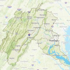
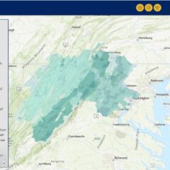
Map of the Potomac River Basin
Use this interactive map to explore sub-watersheds of the Potomac River basin. Click on a watershed to view more information.
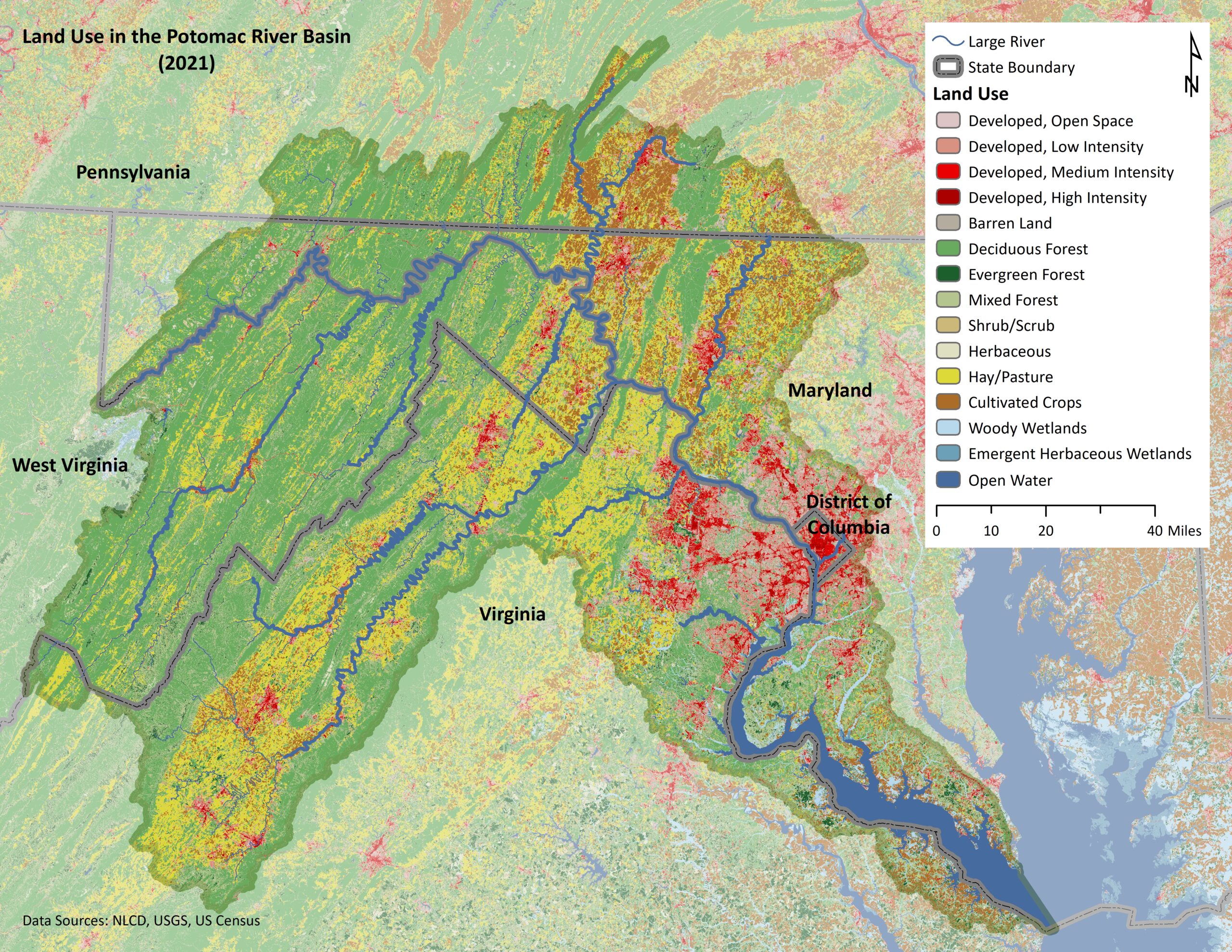
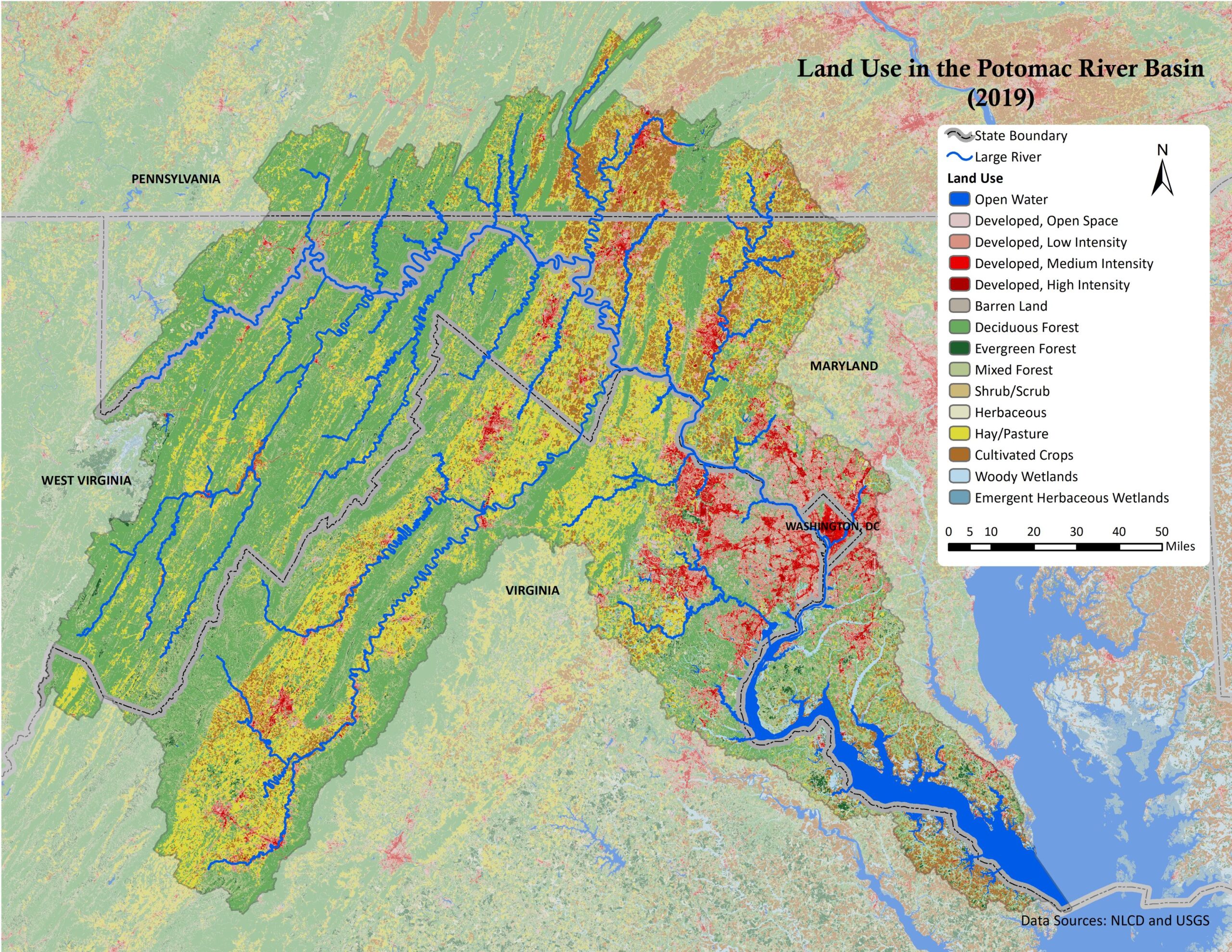
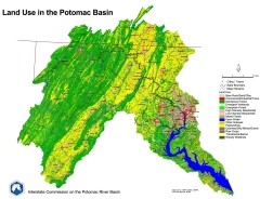
Land Use in the Potomac Basin 2021
Potomac basin map showing land use data from 2021 NLCD.
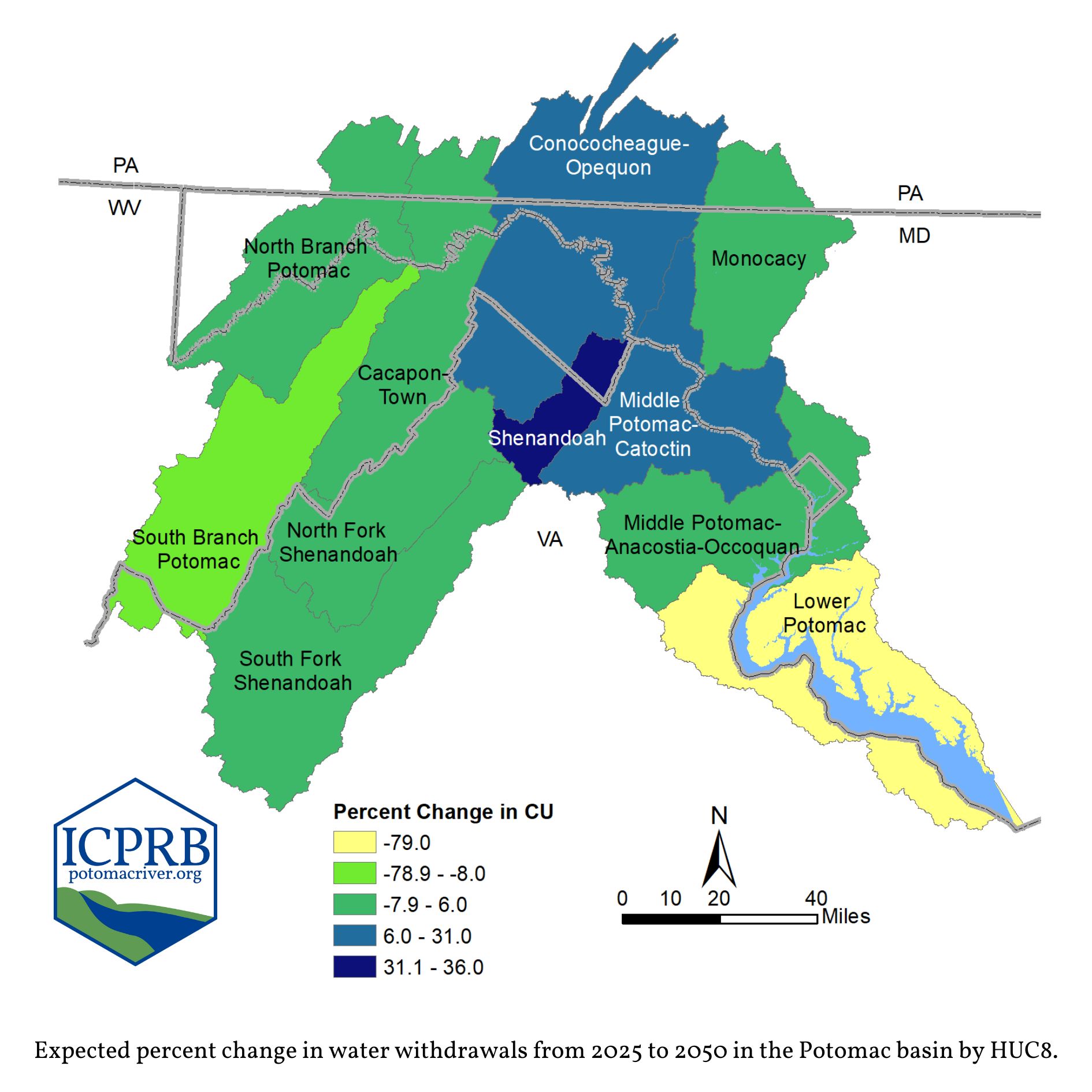
Expected percent change in water withdrawals from 2025 to 2050 in the Potomac basin by HUC8.
This map is from ICPRB's pamphlet, Potomac Basin Trends in Water Use, which summarizes forecasted reported water withdrawals and consumptive use in the Potomac basin. Understanding current and anticipated water use is vital for sustainable water resources planning today and into the future. Consumptive Use (CU) is the portion of water withdrawn from a resource and not returned for subsequent use. Examples of CU: evaporated irrigation and cooling water, bottled drinking water, and water consumed by people or livestock.
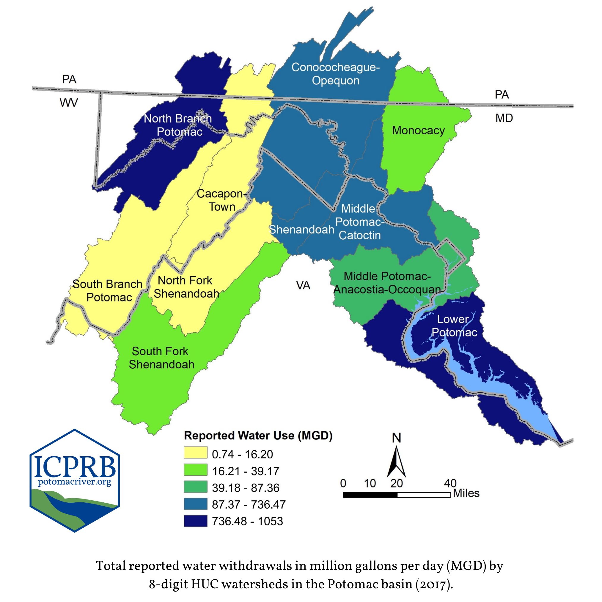
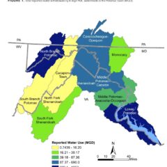
Total reported water withdrawals in million gallons per day (MGD) by 8-digit HUC watersheds in the Potomac basin (2017).
This map is from ICPRB's pamphlet, Potomac Basin Reported Water Use, which is a report on basin-wise water uses.
Wandering through the Watershed
The Potomac River Basin covers about 14,670 square miles through Virginia, Maryland, West Virginia, Pennsylvania, and the District of Columbia. This Story Map is a collection of stories pulled from the weekly ICPRB publication, About the Basin.
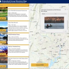
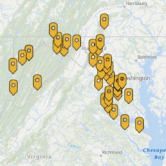
Potomac Watershed Groups
Find stewardship opportunities through local watershed groups.
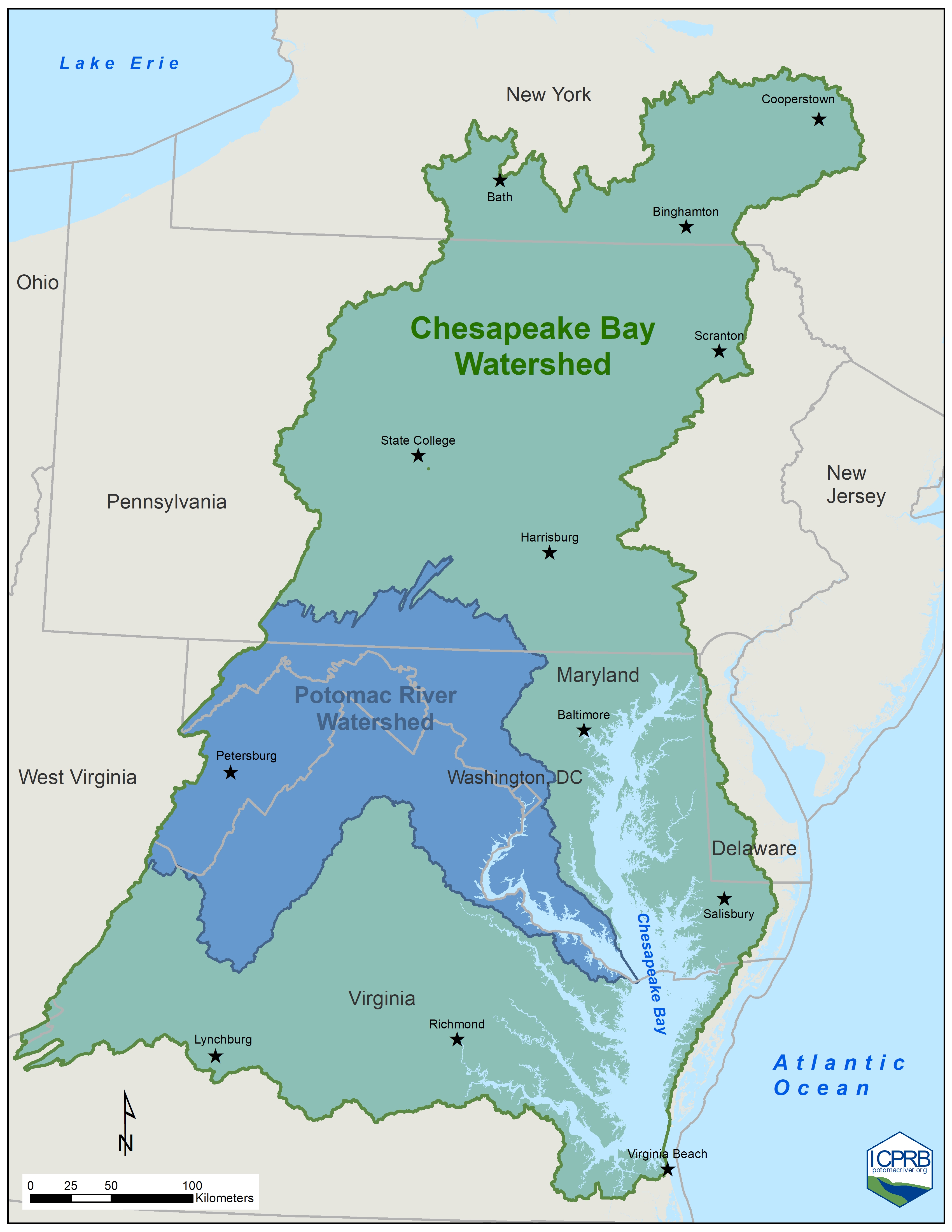
Potomac basin in the Chesapeake Bay Watershed
The Potomac basin is the 2nd largest watershed in the Chesapeake Bay.
Land Prioritization Mapping for Protecting Drinking Water Quality
The Land Prioritization Mapping Project aims to assist land conservation organizations in prioritizing specific parcels of land to obtain the most drinking water quality benefits. The project area encompassed the non-tidal Potomac basin above the DC metro drinking water supply intakes. Within the study area, agricultural and forested lands, as well as riparian areas protected by county ordinance, were considered “opportunity areas” for prioritization. Land parcels were prioritized using seven metrics developed through a collaboration among the eight drinking water suppliers to rank land parcels to protect drinking water quality.
Will Runoff Alter your Streamflow? A look at flow alteration from impervious cover
We know...Very small amounts of impervious cover — less than 2% of watershed cover — can impact local streamflow.
But...Are all the streams and rivers in the Potomac basin equally impacted by impervious cover?
So we asked...Are there some watershed characteristics that make an area’s streams more susceptible to flow impacts from impervious cover? These characteristics include watershed area, karst geology, precipitation, soil characteristics, physiographic province, and slope.
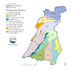
Bioregions of the Chesapeake Bay
This interactive map explores the twelve bioregions of the Chesapeake Bay watershed as they relate to stream macroinvertebrates which include insect larvae, snails, and water beetles. Differences between bioregions in their natural hydrology, topography, and climate affect the composition of macroinvertebrate communities and how they respond to stream degradation. For more information, visit ICPRB’s webpage on the Chessie BIBI Index for Measuring Stream Health.
Reported Water Use in the Basin
Total reported water withdrawals by 8-digit HUC watersheds in the Potomac basin (MGD) from the 2022 report: Potomac Basin Reported Water Use.
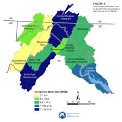
Unreported Water Use
Map of unreported water use in the Potomac River basin.
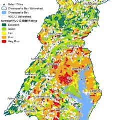
Chessie BIBI
Chessie BIBI (family-level version of the bioregion index) ratings for streams and small rivers in the Chesapeake Bay watershed. When sufficient data (n > 3 catchments) are available, HUC12 watersheds are colored per the rating of their average index score. Otherwise, individual sampling locations are indicated and colored per their ratings.
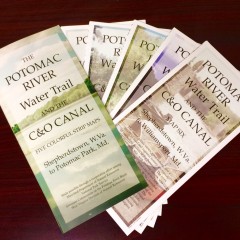
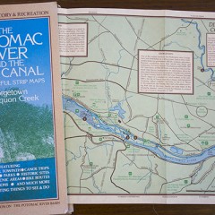
Upper Potomac Map Sets: Shepherdstown, W.V. to Potomac Park, Md.
ICPRB has map sets for the upper Potomac River and its surrounding trails. These maps are a terrific way to get to know the Potomac from Shepherdstown, W.Va., to Potomac Park, Md. Recreational fishing, biking, hiking, kayaking, canoeing, camping, parking, and public boat launch information is included. For the history buffs, there is information about parks and historical sites to satisfy your curiosity.
The maps are printed in color on a tear-proof, waterproof polyester material. Copies are $5 for the set, including postage. To order, please send $5 for each map set to: ICPRB-Maps, 30 West Gude Dr., Suite 450, Rockville, MD 20850.
Lower Potomac River Maps to Download: DC to Opequon Creek
This set of maps, produced by ICPRB with the help of many government agencies and non-profit groups, has been out of print for several years. However, the maps have been updated and digitized and can be downloaded for free. The 10 maps cover the river and C&O Canal National Historic Park from Washington, D.C., to Opequon Creek, a short distance upstream of Shepherdstown, W. Va.
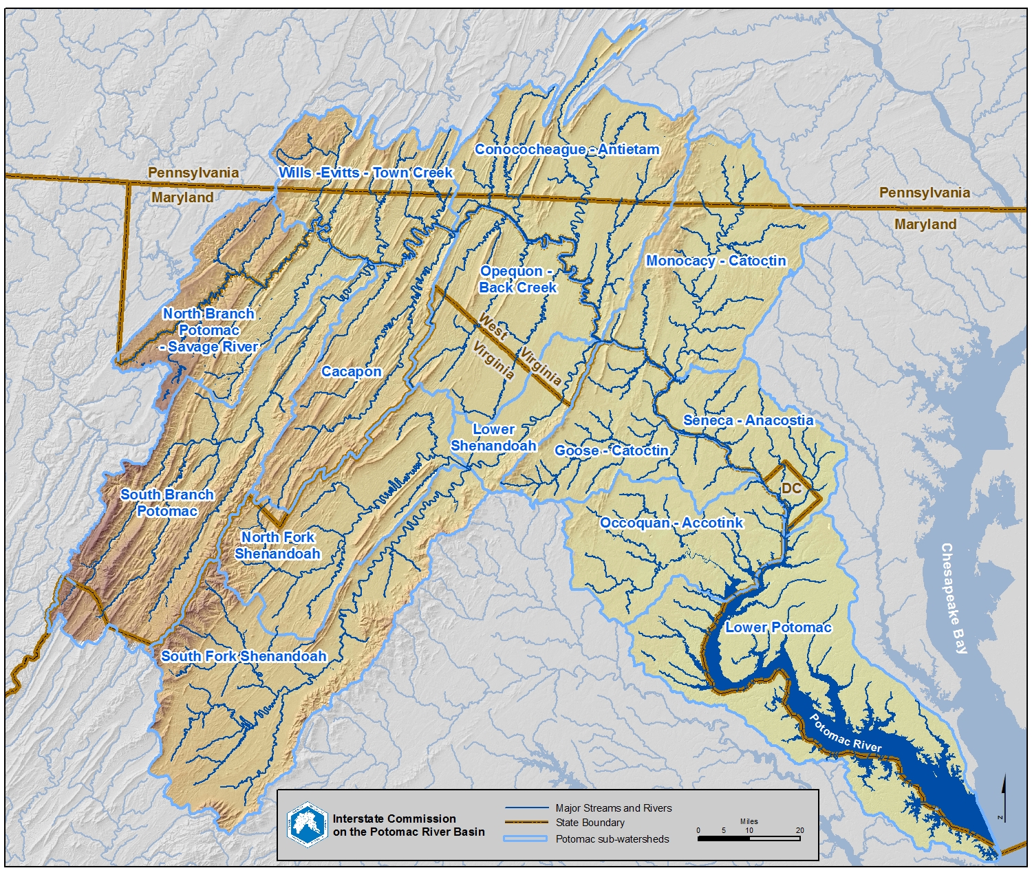
Sub-watersheds of the Potomac River Basin
This downloadable JPG map features the sub-watersheds of the Potomac River basin.
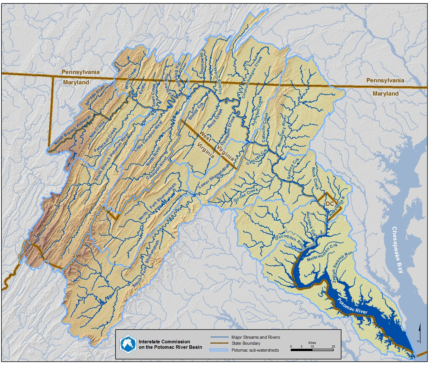
Streams of the Potomac River Basin
This downloadable JPG map features the major streams and rivers of the Potomac Watershed.
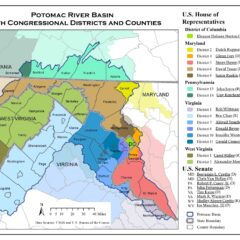
U.S. 118th Congressional Districts Map
Who represents the Potomac River basin? Find your representative with our Congressional Districts Map.
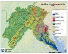
Land Use Map - 2019 Data
Potomac basin map showing land use data from 2019 NLCD.
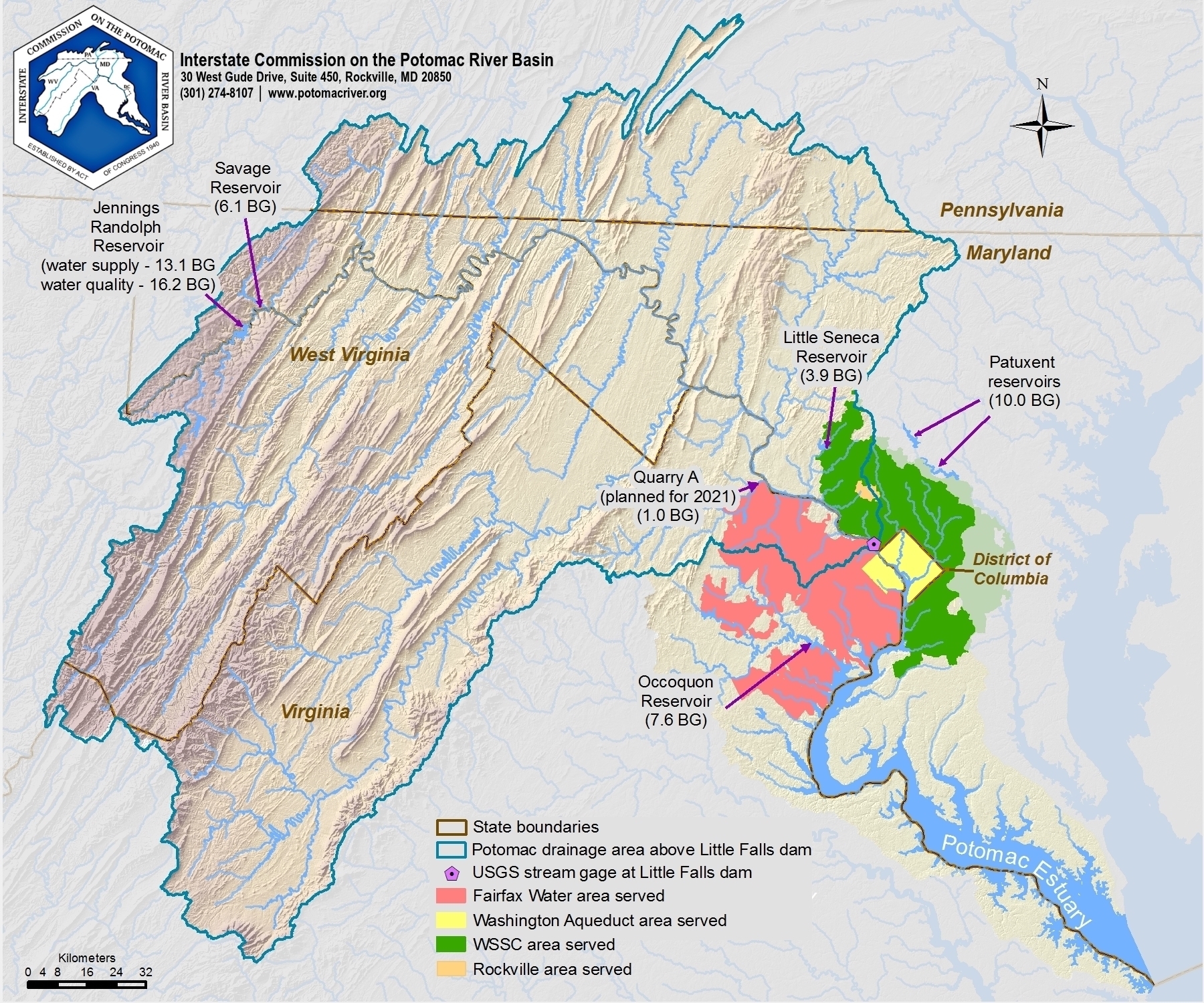
Washington Metro Water Supply Service Areas
Areas served by Fairfax Water, Rockville, Washington Aqueduct, and WSSC and water supply reservoirs.
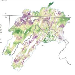
Subwatershed Relief Maps
Download PDFs for the following watersheds:
Potomac and Chesapeake Bay
Monocacy River and Catoctin Creek
Conococheague Creek
Conococheague Creek, Antietam Creek and Licking Creek
Sideling Hill Creek
Town Creek
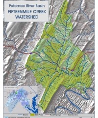
Fifteenmile Creek