News

About the Basin

Entry Thumbnail

Seneca Creek State Park

About the Basin, July 21

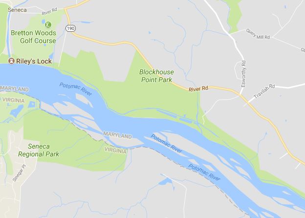
The Seneca Creek State Park runs the length of Seneca Creek from Route 355 until it empties into the Potomac River. It is unique gem in Montgomery County, Maryland. At 6,300-acres, the park covers a lot of ground, allowing for a wide variety of recreational opportunities.

A boathouse on a lake

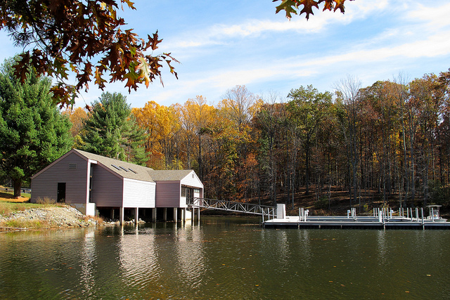
Credit: Flickr, Mr.TinDC, Clopper Lake Boat Center

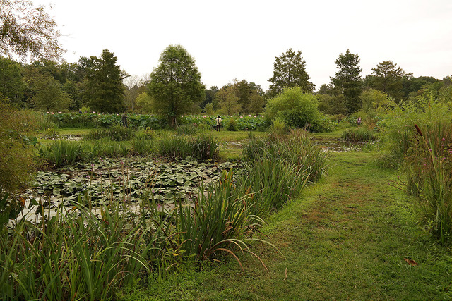
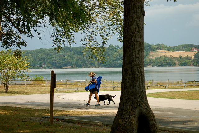
Many of the park activities are centered around a 90-acre body of water called Clopper Lake. Boat rentals, picnic pavilions, playgrounds, and trails surround the lake. Hiking, biking, kayaking, boating (electric motors only), fishing, and hunting are popular activities. A 32-acre Disc Golf course at the park has 36 holes and positive reviews online.

For those brave enough, the Seneca Creek Greenway Trail runs 16.5-miles from the northeastern edge of the park to the southwestern edge, where Seneca Creek meets the Potomac River. There are plenty of other trails for the less intrepid, including the 3.4-mile Lake Shore Trail that takes you around the lake. Schaeffer Farm Area is especially popular with mountain bikers. An online trail map provides trail options and parking lot locations.

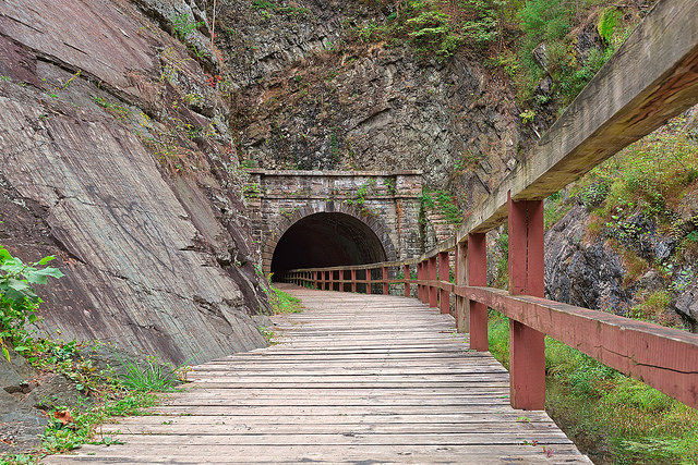
Historical features of the park include the Seneca Schoolhouse, a one-room historic schoolhouse built in 1865 of red Seneca Sandstone. The Black Rock Mill, an old mill, has some mill equipment on display.

The park has a popular winter lights display that opens Thanksgiving weekend where you can take your family on a slow 3.5-mile drive through 350 holiday light displays.

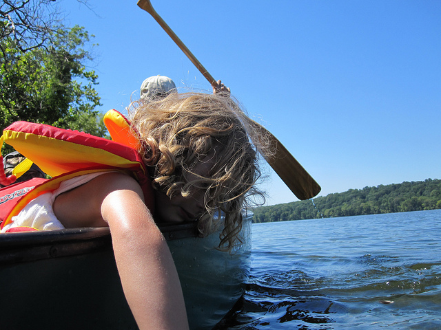
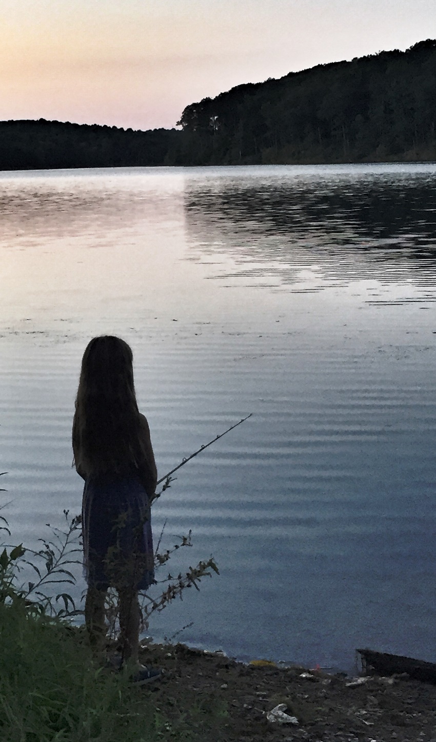
Park staff has a packed calendar of fun activities this summer, including pontoon boat rides, fishing lessons, nature walks, and a kid’s program called “Nature Shack”. Kayaks and canoes are available for rent ($28-40/4 hours) from the boat center. You can also join the outdoor store, REI, on July 29, 2017 for their Learn to Kayak Class ($70) for a perfect excuse to spend some time on the water and learn a new skill.

A boathouse on a lake

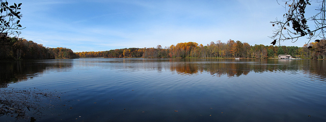
Credit: Flickr, Mr.TinDC, Clopper Lake Panorama

Entry Thumbnail

Kenilworth Park and Aquatic Gardens

About the Basin, July 14

Kenilworth Park and Aquatic Gardens is not your typical national park. “Strikingly beautiful” as one Yelp reviewer called it, it is the only national park solely dedicated to growing

aquatic plants for your viewing pleasure.  And they are really good at it. Located in northeast Washington, D.C., along the Anacostia River, it is known as one of the premier sites for engagement, wedding, baby photoshoots. The colorful aquatic flowers abound throughout the gardens, especially during late June and July when the lotus and lily flowers are in full bloom.

A pond with aquatic flowers next to a walking path.

Credit: Flickr NPS CulturalLandscapes Kenilworth Aquatic Gardens

The aquatic gardens are mainly marshland with many walking paths and boardwalks to enjoy. Pack a picnic to enjoy on one of the many shaded benches or bring a blanket to dine in true picnic-fashion next door at Kenilworth Park. Turtles, beavers, swans, muskrats and a wide variety of other wildlife can be spotted swimming or flying among the flowers. But don’t forget your bug spray!

Summer hours are 9:00am-5:00pm, but it is suggested to get there early as some of the flowers close up due to the summer heat. Many of the trails at the aquatic gardens are wheelchair accessible (but not paved, so it may be muddy after a rain). Wheelchairs are available at the visitor’s center. Want to paddle around the marsh? Head up to Bladensburg Waterfront Park to rent a kayak ($20/day), then paddle the short trip down the Anacostia River to Kenilworth park for an adventurous float through the tidal marshes and water trails. Start out a couple hours before high-tide so you don’t get stranded in the mud.

Enjoy Kenilworth Park and Aquatic Gardens in its glory during the upcoming weeklong Lotus and Water Lilly Festival that kicks off on July 15, 2017. Dance performances, food, demonstrations, arts and crafts, and more will celebrate these exotic flowers. Anacostia Watershed Society is also organizing a free canoe trip through Kenilworth Park on the evening of Thursday, July 20.

Entry Thumbnail

Blockhouse Point Park

About the Basin, July 7, 2017

Blockhouse Point Park is a little-known park that played a large part in history. The park is just north of Great Falls in the western part of Montgomery County on the Maryland side of the Potomac River. To keep an eye on the Confederate troops across the river, Union soldiers used it as a camp and lookout. From high vistas, the C&O Canal and Potomac crossings could be watched closely to prevent enemy raids. Three blockhouses (hence the name) were used as observation points by the Union army. They were eventually burned down by the Confederate troops in 1864. The land was used post-war to search for the Lincoln assassination co-conspirators and to look for Confederate soldiers returning to Maryland because of the excellent views of the Potomac River and its surrounding areas.

Google Map of Blockhouse Point Park

Today, the 630-acre park is used by hikers, bikers, and equestrians. Considered by Maryland-National Capital Park and Planning Commission Department of Parks as one of the Best Natural Areas, it is a microcosm of landscapes with mature upland forest, floodplain forest, palustrine wetlands, streams, river-rock outcrops, and more. It is also home to at least nine species of threatened, endangered, or watchlist plants.

There are 7+ miles of natural surface trails. Much of the trails are designated for hikers only, but there are some “hiker/equestrian” trails and some “shared use” trails. The sole biking trail is the Muddy Branch Greenway Trail that originates in North Potomac, follows the edge of the park, then connects to the C&O Canal Towpath. Two small parking lots are located on the south side of River Road.

On July 15, 2017, Join the C&O Canal Association on a float down the section of the canal that runs through the park. Paddlers will enjoy a trip down the canal from Violette’s Lock just north of Blockhouse Point Park, down to Great Falls. Learn about this event and other fun happenings in the Potomac River basin on ICPRB’s Calendar of Events.

Entry Thumbnail

Path Through Paw Paw

About the Basin, June 30, 2017

Located in western Maryland along the border of West Virginia, the Paw Paw tunnel started out as a way for the Chesapeake and Ohio Canal to bypass 6 miles of horseshoe-shaped bends in the North Branch of the Potomac River. A seemingly simple task, it was expected to take 2 years to complete. The first boat floated through the tunnel in 1850, fourteen years later.

Only a few short miles down the river the C&O Canal ends in Cumberland, Md., instead of the originally planned stopping point of Pittsburgh, Pa., partly due to the expense of Paw Paw tunnel. What could go wrong did go wrong during the construction of the tunnel. Engineering problems, worker riots, financial issues and more plagued the contractors.

Entrance to Paw Paw Tunnel

Credit: Flickr, Nicolas Raymond, Paw Paw Tunnel – HDR

As the saying goes, one man’s trash (or waste of time and money) is another man’s treasure, and this tunnel is a treasure. At 3,118-feet long, it can be enjoyed on foot or by bike, although it is recommended to walk your bike through the tunnel. It is a fun and adventurous look at history, just don’t forget your flashlight (a cell phone flashlight with plenty of battery life would work as well). The trek starts with a .5-mile hike from Paw Paw Tunnel Campground to the entrance of the tunnel. After admiring the archway, breathe in the cool, moist air of the tunnel. A fun walk through the tunnel brings you to a small waterfall on the other end. Once you’ve braved the full length of the tunnel, head back via the 2-mile long Tunnel Hill Trail that goes above the tunnel and includes interpretive signage.

A boat ramp in Paw Paw, W. Va. allows access to those horseshoe-bends in the Potomac River that provide stunning views. Looking for a longer adventure? Enjoy some kayak-camping while you paddle down the twists and turns of the Paw Paw Bends enjoying the rocky gorge. The National Park Service has an example itinerary of a 3-day kayak tour of the area. Don’t feel like going it alone? Join the Potomac Riverkeeper Network’s Paw Paw Bends Float and Camping trip coming up July 15-16.

Entry Thumbnail

The Many Sides of Piscataway Creek

About the Basin, June, 16 2017

We’re switching gears for this week’s About the Basin. Instead of extolling the virtues of a nature reserve or state park, we’ll be travelling down a short stream just south of Washington, D.C. called Piscataway Creek and discovering all the treasures it has to offer.

Beginning just north of Rosaryville, Maryland, the Piscataway runs just 4.5 miles long. The headwaters pass through Piscataway Creek  Stream Valley Park. This park is difficult to access and has few trails. However, if you are in the area, stop by Cosca Regional Park. The main feature of this park is Lake Cosca, which runs into Butler Branch, a tributary of Piscataway Creek. Boat rentals and overnight camping are available in this 690-acre park near Clinton, Md.


Photo credit: Piscataway Creek Canoe Trip (9), Rob Bole, Flickr

About the time Piscataway Creek flows under Indian Head Highway (Route 210), it opens-up into an embayment that provides a variety of recreational opportunities, including hiking, boating, fishing, and educational adventures. The Piscataway Creek Trail can be found on the north side of the embayment. The highlight of this park is a short, easy hike with beautiful views of the river. Just west of the trail is Fort Washington Marina which offers two boat ramps and lots of parking.

Beyond the recreational opportunities, this area is rich with history. The mouth of the river is directly across from George Washington’s Mount Vernon and is largely protected because of its view of this historic piece of land. But long before George Washington dug a hoe into the ground, the Native Americans considered the area a special place. Many organizations work to preserve the history of this creek and its embayment.

On the west side of the marina is Fort Washington Park, one of the few forts still in its original form along the east coast of the United States. An important Potomac River stronghold, this fort showcases how it has adapted to the advances in artillery, ships, and warfare over the past two centuries.

Across the river from the fort is National Colonial Farm at Piscataway Park. In addition to a boat ramp, hiking trails, arboretum, and forest restoration projects, the park hosts a living history farm from the colonial period. Visit the farm to learn what it was like to live as a middle-class family before the American revolution (spoiler alert: they didn’t have wifi!). Join the farm this Saturday (and every Saturday) for Green History Saturday, a look at environmental issues and their relation to contemporary sustainability.

Just west of National Colonial Farm is Alice Ferguson Foundation’s Hard Bargain Farm, an environmental center focused on sustainable agriculture and cultural heritage. Most of the farm’s programs are for local students and teachers, but the center occasionally opens to the public for special events.

Looking to combine water activities and history? As part of Potomac Riverkeeper Network’s Riverpalooza lineup of summer activities, many will load into canoes and kayaks for a Piscataway Creek Paddle to learn about the history of this beautiful creek this Saturday, June 17. Find information on this event and many other fun activities on ICPRB’s Calendar of Events.

Entry Thumbnail

Celebrate National Get Outdoors Day with Back to the Bay Day this Weekend

Much like National Donut Day and Eat Ice Cream for Breakfast Day (June 2 and February 4, respectively, because I know you were wondering), National Get Outdoors

Day on June 10 is a day worth celebrating. As part of this holiday, Mason Neck State Park is hosting the first annual Back to the Bay Day. It will be a day full of live music, local food, drinks, and fun.

Experience the National Park Service’s mobile visitor center, tour Belmont Bay, and sample local oysters at this one day

Photo Credit: Virginia State Parks on Flickr

event that celebrates National Get Outdoors Day and the Chesapeake Bay. Back to the Bay Day is designed to increase public awareness of our regional waterways, from local streams to the entire Chesapeake Bay, and garner excitement for this valuable resource.

Volunteers are needed for Back to the Bay Day. Those interested in volunteering can contact Laura Grape via email or at 703-324-1460.

We don’t want you to stop your outdoor escapades just at one day of adventures, though. Mason Neck State Park is a great place to visit the whole year-round. Less than an hour drive south of Washington, D.C., it is tucked into a peninsula between Belmont Bay, Occoquan Bay, and the Potomac River, and spans more than 1800 acres. Located within the park and listed on the National Register of Historic Places are a Native American camp and a plantation owned by the family of George Mason.

Birding is one of the more popular activities in the park, which is thought to be one of the best places to spot Bald Eagles in northern Virginia. Just to the east of the park is a tract of land called the Elizabeth Hartwell Mason Neck National Wildlife Refuge, which was established specifically as a refuge for these majestic creatures.

Looking to get out on the water? Rent a kayak or canoe near the visitor’s center and make your own adventures out on the bay. You can also enjoy the several miles of paved trails by renting a bicycle from the park.  If you plan on being there for lunchtime, be sure to bring your own food. There are not many places to purchase food in the area.

So, enjoy National Get Outdoors Day, but think about making it National Get Outdoors Week, or Month, or maybe even Year. There is so much to see and do in the beautiful Potomac River watershed. Many  of these great events are listed on ICPRB’s Calendar of Events, including a Twilight Paddling Adventure at Mason Neck State Park the evening after Back to the Bay.

Entry Thumbnail

About the Basin: A Big Birthday

marylandheights11

Harper’s Ferry, W. Va.

The National Park Service turns 100 years young on August 25, 2016.

In 1872, Yellowstone National Park was the first of several areas designated “as a public park or pleasuring-ground for the benefit and enjoyment of the people” under control of the Department of the Interior. As the territories grew, it seemed each new park was administered by a different organization.

One hundred years ago this Thursday, President Woodrow Wilson signed the act creating the umbrella organization that would become the caretaker of our country’s natural wonders, the National Park Service (NPS). A century later, NPS is now responsible for 83 million acres of national treasure.

NPS and other organizations are holding special events to commemorate this historic occasion. Here are a few that are happening in our little corner of the country:

  1. All 412 National Parks are offering Free Admission from August 25-28.
  2. Confluence Festival, Harper’s Ferry, W.Va., celebrates music and arts in honor of the NPS Centennial (August 20)
  3. Niagara (NAACP) Movement Pilgrimage, Harper’s Ferry, W.Va., retraces the footsteps of the civil rights pioneers of the NAACP. (August 21)
  4. Form a human arrowhead (the NPS logo) with thousands of your best friends on the National Mall (August 25)
  5. The North American Ornithological Conference in Washington, D.C., brings science and conservation together (August 16-20)
  6. NPS Centennial Family Festival at Constitutional Gardens in Washington, D.C., celebrates all things NPS (August 27)

Wallace Stegner, an American writer, notes, “National parks are the best idea we ever had. Absolutely American, absolutely democratic, they reflect us at our best rather than our worst.” During this contentious election year, Find Your Park and cast a vote for the absolutely American, absolutely democratic, National Park Service.

Entry Thumbnail

About the Basin—Your Watershed Group Map

WatershedGroupsCivic engagement is the cornerstone of our country. The people and organizations that work tirelessly to improve a little piece of the world makes the whole community a better place to live.

In the Potomac River basin, we are lucky to live in an area where there is an abundance of organizations and stewardship opportunities. ICPRB has compiled a map of groups in and around the Potomac basin that work towards protecting the watershed. The list includes civic groups, regional governments, non-profits, wildlife sanctuaries, and more. It is intended to help basin residents discover local groups so that they can ask questions, volunteer, or learn more about their watershed

Click here to find the Watershed Group map.

If your environmental group is not listed or the information needs to be updated, please complete the online form or contact us.

Entry Thumbnail

About the Basin – Little Seneca Lake

Little Girl Fishing at Little Seneca Lake

Little Girl Fishing at Little Seneca Lake

With a surface area of 505 acres, Little Seneca Lake is anything but little. Built as an important strategic reservoir for drought management in the Potomac watershed, the lake also provides a variety of excellent recreational opportunities. Located just north of Germantown, Md., the lake boasts several boat ramps, plenty of fishing holes, calm sailing waters, a nature center, and so much more.

Activities on the lake center around Black Hill Regional Park. This nature center offers a variety of events for all ages but has a special focus on children’s programs. Art, yoga, campfires and scavenger hunts, all geared towards the littlest family members. Monarch Fiesta Day, held every September, celebrates the exalted butterflies migration to Mexico.

Rent a kayak or take a ride on their pontoon boat Kingfisher to explore the many nooks and crannies of the lake. Fishing kayaks, SUP boards and sail boats are a common weekend sight. A water trail map offers an ecological and historical take on the area.

This bucolic jewel in northern Montgomery County, Md. maintains many miles of paved and natural surface hiking trails. A trail connector project is in the works on the western side of the lake that will soon add 6 miles of scenic hiking opportunities.

Little Seneca Lake is close to the busy cities of the Washington metropolitan area but it feels a world away. Why not take a break and check out all that it has to offer this weekend?

Entry Thumbnail

Four Facts About the Potomac

U.S. Geographic Board Decision Card

U.S. Geographic Board Decision Card

1. Thought by some to mean “something brought”, the Potomac owes its name to the Native American Algonquian village, the Patowmeck. The river’s name went through many iterations until the United States Geographic Board settled on the final spelling and pronunciation in 1931.

2. It is a common myth that Lyndon B. Johnson called the river a “national disgrace.” However, the actual quote is not far off. During the Water Emergency Conference in 1965, President Johnson spoke to governors and other state officials about the water crisis faced by the northeastern states. He talked of the water crisis as both a national problem and a regional problem, summoning the state of the Potomac river as an example: “It is disgraceful. I was out on it last night and you can hardly go down the river without reflecting and wondering why we have been so shortsighted these years. And it has got to stop. We have got to do something about it. And good men, and great men, and wise men, and good Americans, like you, can do something about it.”

3. The Potomac river has 6.11 million people within its watershed and covers almost 15,000 square miles. It reaches into West Virginia, Virginia, Maryland, Pennsylvania and the District of Columbia. Coordinating a reliable supply of drinking water among many jurisdictions is a big challenge. To work cooperatively and efficiently, almost two dozen water suppliers and government agencies have come together to form the Potomac River Basin Drinking Water Source Protection Partnership (DWSPP). Through strategy building, work groups, educational meetings, and more, the members of DWSPP work toward a comprehensive approach to protecting drinking water supplies.

4. The non-native fish in the Potomac, the northern snakehead fish and blue catfish, are commonly written about in the media and well known by the public. But did you know that the bastions of Potomac fishing, the Largemouth and Smallmouth Bass, are also not a native species to the Potomac river? Back in 1854, General William Shriver carted a number of Black Bass (a name given the group of fish of which these two species are included) in the water tank of a B&O railroad train from the Ohio river, intending to release them in the C&O Canal. The fish quickly spread. As an 1874 article in the Baltimore American stated, “From this small beginning, sprang a noble race of fish which now swarm the river.” The rest, as they say, is history.