News

About the Basin

Entry Thumbnail

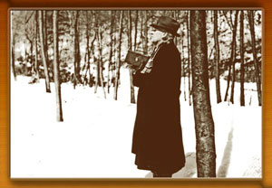
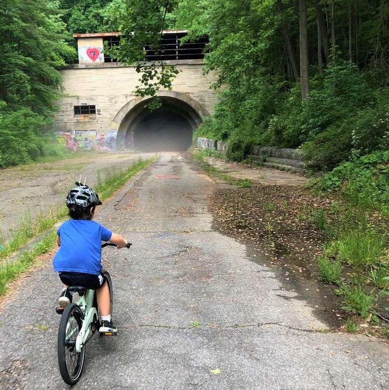
About the Basin: Catoctin Mountain Park

Catoctin Mountain Park

Thurmont, MD

A man sits on a rock overlooking a valley of trees in the fall.

Photo Credit: Peggie Gaul (NPS)

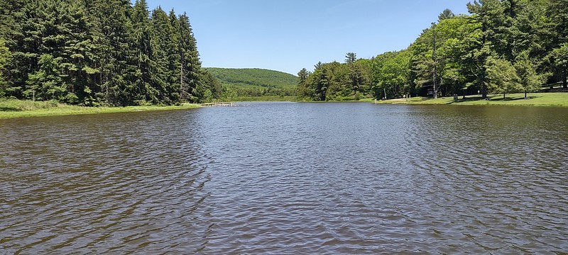
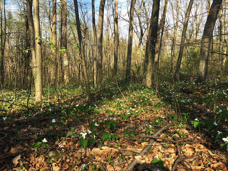
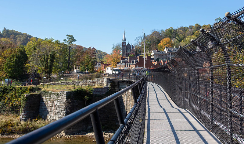
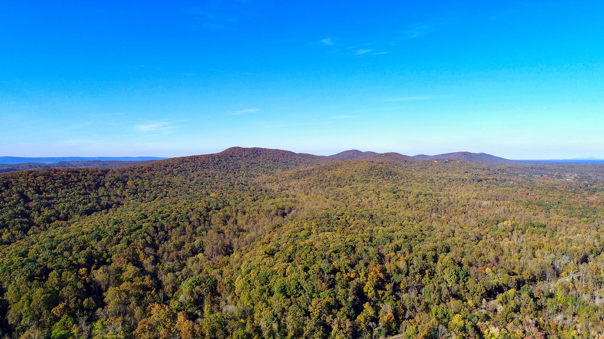
As summer comes to a close and kids start returning to school, our thoughts turn to cooler weather, autumn color changes, and less-sweaty outdoor activities. There are many places to catch the leaves change in the Potomac River basin. Hiking, fishing, and boating in the region can be top notch when the weather is cool and the sun stays up late. The Catoctin Mountain Park near Thurmont, Maryland, is one of the more popular places for “leaf peeping.” It’s not just the fact that it is within an easy drive from the DC Metro Area, but it is also part of a larger area of public lands that stretches through Cunningham Falls State Park, Middletown and Frederick watersheds, and beyond. The contiguous stretch of second-growth mixed hardwood forest creates a dramatic view from both the freeway and the trailway.

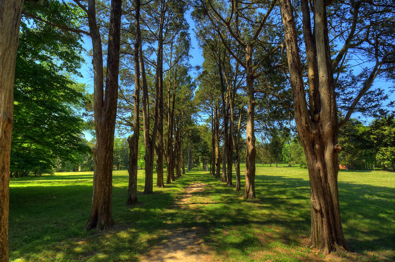
With 25 miles of hiking trails in Catoctin Mountain Park, and even more trails connected to Cunningham Falls State Park, there are many opportunities to get your fall fix.

There are also plenty of opportunities for grabbing a cozy blanket and a pumpkin spice latte and watching the wildlife go by as you sit by a cozy campfire. Owens Creek Campground, Camp Round Meadow, and Camp Misty Mount have a variety of campsites and cabins.

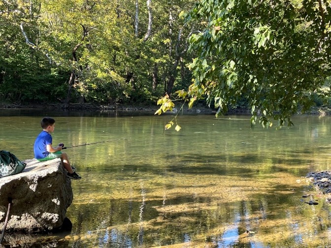
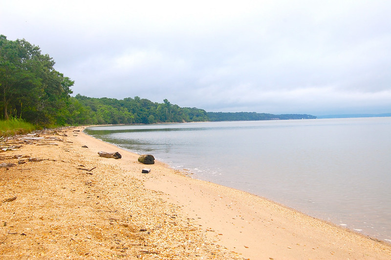
The creeks are clear and clean. It is common to see folks fly fishing for brook, brown, and rainbow trout in the cool water. Big Hunting Creek, one of the largest creeks in the area, was one of the first Maryland streams to be designated as a “fly-fishing only” stream. There are some regulations to know, so make sure to read-up before you grab your tackle box.

For the more adventurous out there, the rock climbing and bouldering opportunities abound.

The park started as the Catoctin Recreation Demonstration Area to allow “city folk” a chance to enjoy the outdoors during the Depression. It was part of the many Civilian Conservation Corps programs that we still benefit from today. Stone from local quarries and logs from recently-felled American Chestnut trees affected by the blight were used to build the cabins in the 1930s. A decade later, those same cabins were used for military training during WWII, with the added bonus of providing additional protection for nearby Camp David.

As part of the National Park System, rangers at the visitor’s center (open daily) provide maps, a bookstore, history of the park, and educational materials on the flora and fauna you will experience there.

Entry Thumbnail

About the Basin: New Germany State Park

New Germany State Park

403 McAndrews Hill Rd, Grantsville, MD

Nestled within the expansive arms of Savage River State Forest in Western Maryland, New Germany State Park sits in the valley between Big Savage Mountain and Meadow Mountain.

The Lake House is where the action is at New Germany. It is where staff hold park-sponsored events, a snack bar provides sustenance and souvenirs to weary adventurers, and the large Black Forest Room is available for events or conferences. A nature center and native plant garden introduce visitors to the local flora and fauna. Canoes, kayaks, standup paddleboards, and row boats are available for rent from the Lake House.

A vintage photo of a man with a dark jacket standing in the snow, holding a camera.

Photo credit: Fred Besley with camera in hand at the opening of the ski resort– 1941 (MD DNR).

At one point in history this area was known as the “Maryland Alps” when downhill skiing became popular in the 1940s. It was the venerable forester Fred Besley who knew the best way to get public opinion in favor of states forests was to get the public in the forests, so he and a team of foresters worked to install Maryland’s first ski resort in Maryland. Although the resort closed a few decades later, the popularity of cross-country skiing and snowshoeing continues for locals and tourists alike. Rental equipment is available at the Lake House, as well as a chance to get warm after a day playing in the snow.

The New Germany lake is small but provides a picturesque view year-round. Anglers may find largemouth bass, catfish, bluegill, and stocked trout.

Grab your floaties and sunblock to jump into the lake at the designated swimming beach.

A variety of cabins and campsite options include some winter camping possibilities. The twelve rentable cabins are fully furnished and available year-round. They are perfect for a quiet weekend away with family or friends. The campground provides shady spots and a central bathhouse with restrooms and showers. A couple spots are available with RV hook-ups. Two of the campsite loops provide year-round camping opportunities with a heated bathhouse.

There is no cell phone service at the park, so plan accordingly.

New Germany Lake surrounded by trees with a mountain in the background.

Photo Credit: New Germany State Park, Nicole Sharp (Flickr).

Entry Thumbnail

About the Basin: G. Richard Thompson Wildlife Management Area

Thompson Wildlife Management Area

July 15, 2022

Markham, VA

Thompson WMA forest with a carpet of large-flowered trillium flowers.

Photo credit: Judy Gallagher, Large-flowered Trillium – Trillium grandiflorum, G.R. Thompson Wildlife Management Area, Linden, Virginia (Flickr)

Richard Thompson Wildlife Management Area, or Thompson WMA for short, is a gem of a recreational area in northwestern Fauquier County, Virginia. It is close enough for a day trip from the DC Metro area but far enough to make it feel a world away.

The highlight of Thompson WMA is the abundance of large-flowered trillium in the spring. Each spring, around Mother’s Day, the forest floor is carpeted with these showy, colorful flowers for as far as the eye can see. It’s not just the flowers that put on a show. The birds are in competition with the trillium for Best in Show. The stunning colors of birds like the cerulean warbler and scarlet tanager mix with the sights and sounds of a plethora of migrating and residential birds, creating a bird-watchers paradise. A Virginia Department of Wildlife Resource video, Trillium Bloom at Thompson WMA, shares some of the treasures you can find on a spring morning.

The Appalachian Trail runs through Thompson WMA along the crest of the Blue Ridge mountains. Various trails branch off the Appalachian, creating a network of rugged, but rewarding, hiking trails. The trails are multi-use, including equestrians, so don’t be surprised if you come upon a horse or two.

Dress in your finest orange attire during hunting season since this is a popular area for hunters. Deer are the most sought after, but turkey, woodcock, grouse, and other small game are possibilities.

Wildlife management areas are managed for wildlife and humans get the benefit. But that also means that there are few amenities, trails can be rugged, and roads can be rutted. Plan accordingly.

There are 11 designated parking areas throughout the WMA. Cell reception is spotty, so if you plan to meet a friend, make sure to agree on a specific parking area in advance.

Please make sure to follow the permitting requirements when utilizing public land. Anyone over the age of 17 requires an access permit to visit a Virginia Department of Wildlife Resources-owned wildlife management area. Hunting and fishing licenses are required for their respective activities. Additionally, there are special permitting requirements for camping in Virginia’s wildlife management areas.

Entry Thumbnail

About the Basin: Seven Bends State Park

Seven Bends State Park

July 1, 2022

Woodstock, Va.

Young boy with a fishing pole sitting on a rock in the Shenandoah River. The Seven Bends State Park is named for the twists and turns of the North Fork Shenandoah River as it meanders along the base of the Powell Mountain in northwestern Virginia. It is those same twists and turns that makes one feel they are the sole occupant of this small slice of undisturbed nature.

As part of the Massanutten mountain range, the area is on the ancestral land of the Indigenous nations of Manahoac, Massawomeck, and the Shawandasse Tula.

The Park is one of Virginia’s youngest state parks. It quietly opened in 2020, but the official dedication took place in June 2022 to great fanfare as it joined the state’s 40 other state parks.

There are two access points to the park. The Hollingsworth access at 2111 S. Hollingsworth Rd. will bring you to a large open field with plenty of parking and a kayak/canoe access point. It is tough to reach the river here, so if that is your destination, choose the Lupton access point at 1191 Lupton Rd. This provides a smaller parking lot, but easy access to trails and plenty of fishing spots along the 3-miles of riverfront. Alternatively, you can put your canoe, kayak, or tube in at Hollingsworth access and float the 3 miles (and roughly 1-2 hours) down to the Lupton access.Map of Seven Bends State Park.

Smallmouth bass are the most popular fish for anglers; however, you may also spot sunfish, fallfish, largemouth bass, and muskellunge (please follow all fishing license requirements).

Picnic tables provide a nice gathering place for before or after your trek on any one of the 8 miles of trails. Interesting sites await if you brave the steep trails, including the remnants of two centuries old water reservoirs. One is in ruins but the other still provides an abundant ecosystem (and good fishing).

The area is open every day from 6 a.m. until dusk. There are no overnight accommodations (yet, anyways). The park’s Master Plan calls for campground and visitors center focused on environmental education.

Photo Credits: ICPRB and Google Maps

Entry Thumbnail

About the Basin: Harpers Ferry National Historical Park

Harpers Ferry National Historical Park

June 17, 2022

Photo Credit: David Brossard, Do You Know the Way to Harpers Ferry (Flickr)

Harpers Ferry National Historical Park, and its dramatic history, have been explored and extolled by many and for good reason. The town is steeped in history, and it is evident as you walk through the historic village with its living history storefronts and gaze upon the imposing cliffs across the river.

Harpers Ferry sits at the confluence of the Shenandoah and the Potomac rivers in West Virginia. It also “sits at the confluence of history and nature” (National Park Service). It is said that history repeats itself, and that is no different for this small town perched at the meeting spot of two large rivers. Few people have made the area home in the past few hundred years, but the transportation possibilities and natural resources meant,  “The region was used as a highway, a hunting ground, and a place for raiding and trade,” according to a 2017 NPS Report. The Tuscarora and Shawnee tribes built temporary villages in the area, and it was where Catawba and Delaware tribes would clash.

After a series of treaties, broken promises, and finally, the French and Indian War, the indigenous population moved West and European settlers eventually moved into the area in the early eighteenth century.  It continued to be a place of transition as it was repeatedly razed by floods, fires, and war. The people were resilient and continued to populate the area, build up the town, and then rebuild after disaster strikes.

The area is best known for the raid by the abolitionist John Brown, which was considered a pivotal step towards civil war. The town was torn apart by the Civil War. It changed hands, from Confederate to the Union forces, eight times during the war.  A beacon of hope that came from the ashes of war was the development of Storer College, a post-war institute of higher education for formally enslaved people. Supported by the Freewill Baptists, Storer College used many of the wartime buildings to grow their campus. Beyond education, the college provided a sense of community. The college closed its doors in 1955 but you can still explore the former campus.

In addition to history, the Park provides access to the Appalachian Trail/C&O Canal Tow Path by way of an adventurous pedestrian bridge next paralleling a busy railway over the Potomac River. Take a detour off the tow path and hike up to Maryland Heights for a stunning view of the town and the rivers.

Each Saturday and Sunday throughout the summer, you can join National Park Service staff as they tell “The Story Behind the Scenery.”

Entry Thumbnail

About the Basin: Gunston Hall

Gunston Hall

June 3, 2022

Trees on either side of a path at Gunston Hall, Lorton, Va.

Photo credit: Craig Fildes, Flickr

If you like your hiking with a healthy serving of history, then George Mason’s Gunston Hall is the place for you. The Founding Father’s home is situated along Gunston Cove where Pohick and Accotink Creek meet the Potomac River along the Virginia shoreline. This area is the native land of both the Piscataway and Doeg tribes.

Gunston Hall may not have the grandeur of other Founding Father’s homes, but it also doesn’t have the crowds and traffic. It is a low-key experience that is rich in history and nature. Purchase a $5 pass to explore the grounds which portray the high stature of George Mason with graceful European-style landscaping. A $10 pass will get you access to both the museum and the grounds, which are open from 9:30 am to 6:00 pm.

The website offers short snippets to read or listen to while you wonder the grounds. Up for exploration is the kitchen, the dairy, the laundry facilities, the quarters where enslaved people lived, the school house, and more. After traveling through history, enjoy a little nature by choosing one of the three short hiking trails. The Bluebird trail takes you on a tour of the bluebird boxes, while the Bluff Trail and River Trail are a bit more difficult but offer beautiful views of the Gunston cove and the Potomac River.

Summer Saturdays at the hall provide a themed event with a different theme each Saturday. These drop-in days hold archaeology, gardening, food, and other historical programs.

Looking for more activities in the area? Gunston Hall is near Mason Neck Occoquan Bay National Wildlife Refuge and Occoquan Bay National Wildlife Refuge.

Entry Thumbnail

About the Basin: Bull Run Mountains Natural Area Preserve

Bull Run Mountains Natural Area Preserve

August 20, 2021

The Bull Run Mountains Natural Area Preserve is an outdoor living laboratory located only an hour drive from the D.C. Metro area. It is staffed with Natural Area Preserve managers who carefully oversee the 2,486 acres to preserve the impressive biodiversity and the unique forest and woodland communities found on the mountain.

A wide-angle view of a mountains during autumn.

Photo Credit: Virginia Outdoors Foundation

Since 2002, Bull Run has been owned and managed by the Virginia Outdoors Foundation (VOF) which was established to promote the preservation of open-space lands and to encourage private gifts of money, securities, land or other property to preserve the natural, scenic, historic, scientific, open-space and recreational areas of the Commonwealth. They protect 850,000 acres across Virginia.

In an effort to balance public use with the preservation of the natural ecosystem, the northern section has restricted access, and the southern section is only open to the public Fridays, Saturdays, and Sundays. The public can access the area by way of 7-miles of hiking trails, public programming, and volunteer opportunities. Grab a trail map to find the hikes that lead to picturesque views of the Blue Ridge mountains. A few simple rules apply during your visit: please stay on the designated trails, no dogs are allowed, and practice Leave No Trace principles. They also host school-aged children, university students, and researchers. There is an active stream restoration and monitoring program on site.

Cultural history is an important part of the VOF program. The area is part of the ancestral land of the Manahoac Indigenous people who practiced prescribed burning to create a wildlife habitat conducive for hunting. However, according to notes by the explorer John Smith, they did not burn the hills along Bull Run and throughout the Blue Ridge mountains. The VOF protects many regionally important cultural history sites on the land. Staff provide guided hikes with titles such as Black and African American History of the Preserve and a spooky Cemetery Night Hike. Volunteers are a vital part of the program, so if this sounds interesting, contact them to find out more.

Not too far from Bull Run Mountains Natural Area Preserve, the Bull Run Mountains Conservancy works to protect the region through education, research, and stewardship. They provide engagement opportunities throughout the year at nearby areas like Leopold’s Preserve. The Halloween Safari is an annual event at Leopold’s Preserve, which is a not-as-spooky-as-it-sounds nighttime hike followed by a bonfire and live music.

Contact these organizations to learn more about the recreation, education, and volunteer opportunities in the area.

Entry Thumbnail

About the Basin: Buchanan State Forest

Buchanan State Forest

Looking for history, hiking, adventures, and a beautiful view in one easy stop? The Buchanan State Forest in south central Pennsylvania is the place to be. The land straddles the northern edge of the Potomac River basin. One side of the mountain range drains to the Potomac while the other side drains to the Susquehanna.

History

Boy riding into an abandoned tunnel. Lush vegetation on both sides of the trail.

Abandoned Pennsylvania Turnpike – Pike 2 Bike Trail

The 69,703-acres of dense forest contains ample United States history. This includes the remnants of a road used to supply British troops during the French and Indian War, a saltpeter mill used during the American Revolution, cemeteries from the antebellum era, and a CCC camp that housed conscientious objectors and German prisoners of war during World War II. The hometown of our 15th president, James Buchanan, is nearby at the compact Buchanan Birthplace State Park where you’ll find a monument to the president as well as picnic areas and a fishing stream with native brook trout.

When the Pennsylvania Turnpike first opened in 1940, two of the tunnels were one-way. Seeing the error of their ways, authorities abandoned the tunnels in favor of a more expedient bypass. The abandoned section is now known as the Pike 2 Bike Trail, an 8-mile stretch of slightly-eerie, graffiti-ridden trail that includes the abandoned tunnels.

Adventure

The Pennsylvania Department of Conservation and Natural Resources (DCNR) provides several maps for recreation in the area, including ATV trails, snowmobiling trails, and cross-country ski trails. There is a wide variety of hiking trails to choose from depending on your interests and skill-level. The short and easy Sideling Hill History Trail leads to an almost 200-year old aqueduct. Most trails allow mountain biking and horseback riding. Hunting and fishing are permitted throughout the state forest (with the right license and within season). Native brook trout can be found in several streams and DCNR stocks some of the streams.

Primitive campsites are available for tents, hike-in or RVs. The sites are free but require a Camping Permit.

The many high mountain ridges provide a variety of scenic overlooks, including the aptly named Big Mountain Overlook. Most of the vistas are accessible by car which make it a popular place for leaf peepers searching for dramatic fall colors.

Feel like getting your hands dirty? Grab your gloves and clippers and join the Friends of Buchanan State Forest (find them on Facebook) for their monthly Trail Work Days.

Headed to the Buchanan State Forest for your weekend adventure? Tag us on social media and let us know what you think!


Sign up for our newsletter and like us on Facebook, Twitter, or Instagram to learn more about the Potomac River basin.

Entry Thumbnail

About the Basin: Caledon State Park

This National Natural Landmark is 2,587-acres along the banks of the tidal Potomac River in King George, Virginia.

A gravelly beach along the Potomac River.

Caledon State Park by Virginia State Parks License CC BY 2.0

Visitors love the well-maintained trails with plenty of easy, moderate, and difficult levels to choose from. Park staff offer a variety of fun and informational events from full moon kayak tours to fossil finding adventures.

At one point in history sharks roamed the park. At least when the park was underwater during prehistoric times. In modern times people enjoy spending a day looking for the dental remains of the prehistoric sharks along the shore of the river.

The park boasts more than 200 species of birds, but bald eagles are the crown jewel of Caledon State Park birding. The area has the largest concentration of the national icon on the East Coast and as many as 60 eagles have been spotted in the park. The staff holds several eagle tours throughout the year. Check out their Events page to find an upcoming option.

The park offers 6 campsites that are available as hike-in, bike-in or paddle-in only. They are first come first serve. Call (800)933-7275 to reserve your spot since the online reservation system will not work for these spots. The camp sites are part of the Captain John Smith Chesapeake National Historic Trail, a series of water trails that trace the voyage of the English explorer. The sites are located roughly 3-miles from the parking lot, so be prepared to pack or bike in supplies, including drinking water. This is the tidal Potomac, the water is brackish and therefore too salty to drink.

A welcoming visitor’s center is open 10:00am – 4:00pm, Wednesday through Sunday. They provide historic information, maps, and advice on how best to enjoy the park. Please note that park staff request that unvaccinated visitors must wear face coverings inside all park facilities and where social distancing is not possible.

Caledon State Park is one place you need to look both up and down to enjoy everything the park has to offer. You may spot a bald eagle soaring above or spot a shark tooth along the shore, but either way, you will enjoy your day at the park.

Entry Thumbnail

About the Basin: Piscataway Creek

Piscataway Creek

We’re switching gears for this week’s About the Basin. Instead of extolling the virtues of a nature reserve or state park, we’ll be travelling down a short stream just south of Washington, D.C. called Piscataway Creek and discovering all the natural and historical treasures it has to offer.
Beginning just north of Rosaryville, Maryland, the Piscataway runs just 4.5 miles long. The headwaters pass through Piscataway Creek Stream Valley Park. This park is difficult to access and has few trails. However, if you are in the area, stop by Cosca Regional Park. The main feature of this park is Lake Cosca, which runs into Butler Branch, a tributary of Piscataway Creek. Boat rentals and overnight camping are available in this 690-acre park near Clinton, Md.
About the time Piscataway Creek flows under Indian Head Highway (Route 210), it opens-up into an embayment that provides a variety of recreational opportunities, including hiking, boating, fishing, and educational adventures. The Piscataway Creek Trail can be found on the north side of the embayment. The highlight of this park is a short, easy hike with beautiful views of the river. Just west of the trail is Fort Washington Marina which offers two boat ramps and lots of parking.
Beyond the recreational opportunities, this area is rich with history. The mouth of the river is directly across from George Washington’s Mount Vernon and is largely protected because of its view of this historic piece of land. But long before George Washington dug a hoe into the ground, the Native Americans considered the area a special place. Many organizations work to preserve the history of this creek and its embayment.
On the west side of the marina is Fort Washington Park, one of the few forts still in its original form along the east coast of the United States. An important Potomac River stronghold, this fort showcases how it has adapted to the advances in artillery, ships, and warfare over the past two centuries.
Across the creek from the fort is National Colonial Farm at Piscataway Park, managed by the Accokeek Foundation. In addition to a boat ramp, hiking trails, arboretum, and forest restoration projects, the park hosts a living history farm from the colonial period. Visit the farm to learn what it was like to live as a middle-class family before the American revolution (spoiler alert: they didn’t have wifi!).
Just west of National Colonial Farm is Alice Ferguson Foundation’s Hard Bargain Farm, an environmental center focused on sustainable agriculture and cultural heritage. Most of the farm’s programs are for local students and teachers, but the center occasionally opens to the public for special events, such as last Saturday’s Pinot on the Potomac.