News

Entry Thumbnail

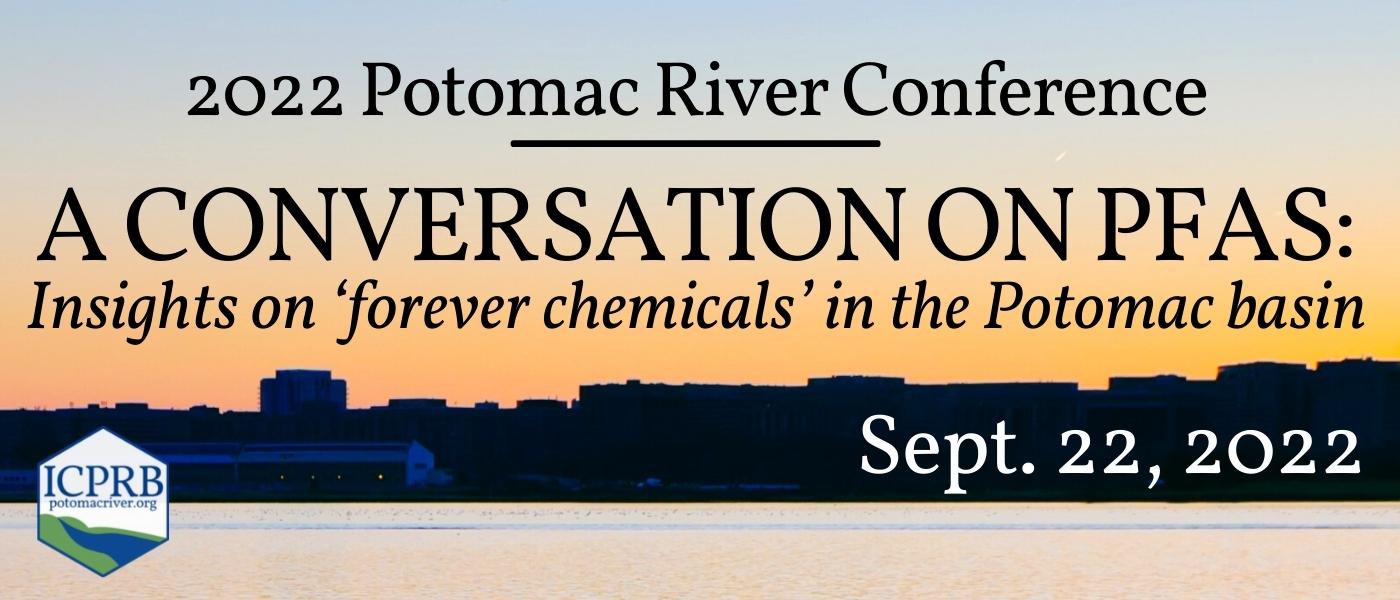
A Watershed Moment for Swimming in the District’s Waters

On June 8, 2022, the U.S. House passed HR 7776 that would authorize the federal government to conduct a feasibility study for recreational access, including “enclosed swimming areas,” in the Potomac and Anacostia Rivers.

An historical look at swimming in the Potomac River

Human contact with the Potomac River predates recorded history and has been continuous through the present day throughout the basin with the exception of the waters of the District of Columbia.

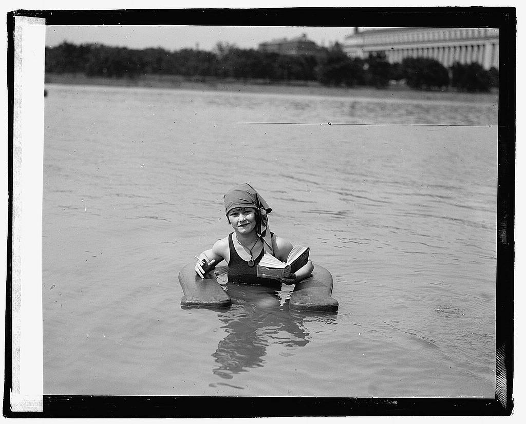
Photo Credit: Muriel Quackenbush in surf chair at Wash. Bathing Beach.1922 (LOC)

The river in the District has long suffered the strain of a concentrated population and the subsequent pollution it creates.

But the Potomac River has shown its resilience and times are changing. The U.S. House recently passed a bill that authorizes a feasibility study of enclosed swimming areas in the District’s rivers. The D.C. Department of Energy and the Environment is looking at updating regulations, water quality standards, and monitoring practices. D.C. Water’s massive infrastructure rebuild, the Clean Rivers Project, is expected to reduce combined sewage overflow by 96%. Organizations like Potomac Riverkeeper Network and Anacostia Riverkeeper are working hard to gather the data as well as change the tide of public opinion for swimming in D.C. waterways. Here at ICPRB, we know the public is curious because we get asked throughout the summer, “Is it Safe to Swim in the Potomac“?

It has been decades in the making, but it is apparent that we are approaching a watershed moment for swimming in District waters.

So, let’s explore a century of policies, engineering, and advocacy that got us to where we are today.

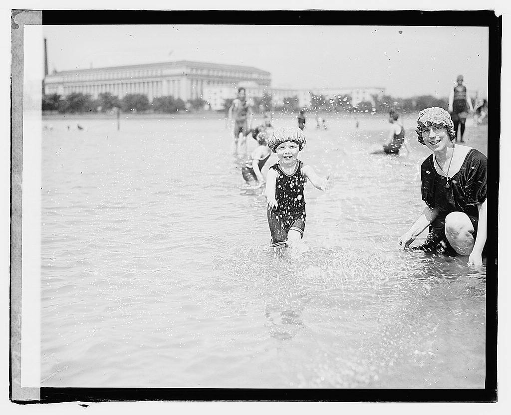
Photo Credit: Margaret Gass (LOC)

The growing population of the early 1900s used the waterway for waste disposal—human waste, industrial waste, agricultural waste—it all went in the river. As the population continued to increase, the tidal waters of the District grew increasingly worse. The tidal basin and other areas were popular swimming holes in the early part of the century until legislation restricting swimming began in the early 1930s. See below for a slideshow of photos highlighting the summer fun of the roaring ’20s

The population of the metropolitan area doubled in the 1940s, the same decade that ICPRB was established. The ICPRB’s first order of business was to collect data for the basin’s initial assessment.  ICPRB was tasked with answering the question, “How bad was it and why?” The study found that the vast majority of the river’s population was served by primary sewage treatment, which means that only solids were removed from raw sewage. The report also noted the importance of the river in people’s daily lives through recreation, fishing, and transportation.

A man stands in a boat, holding his nose. Across the river is an industrial complex with several smokestacks blowing smoke.

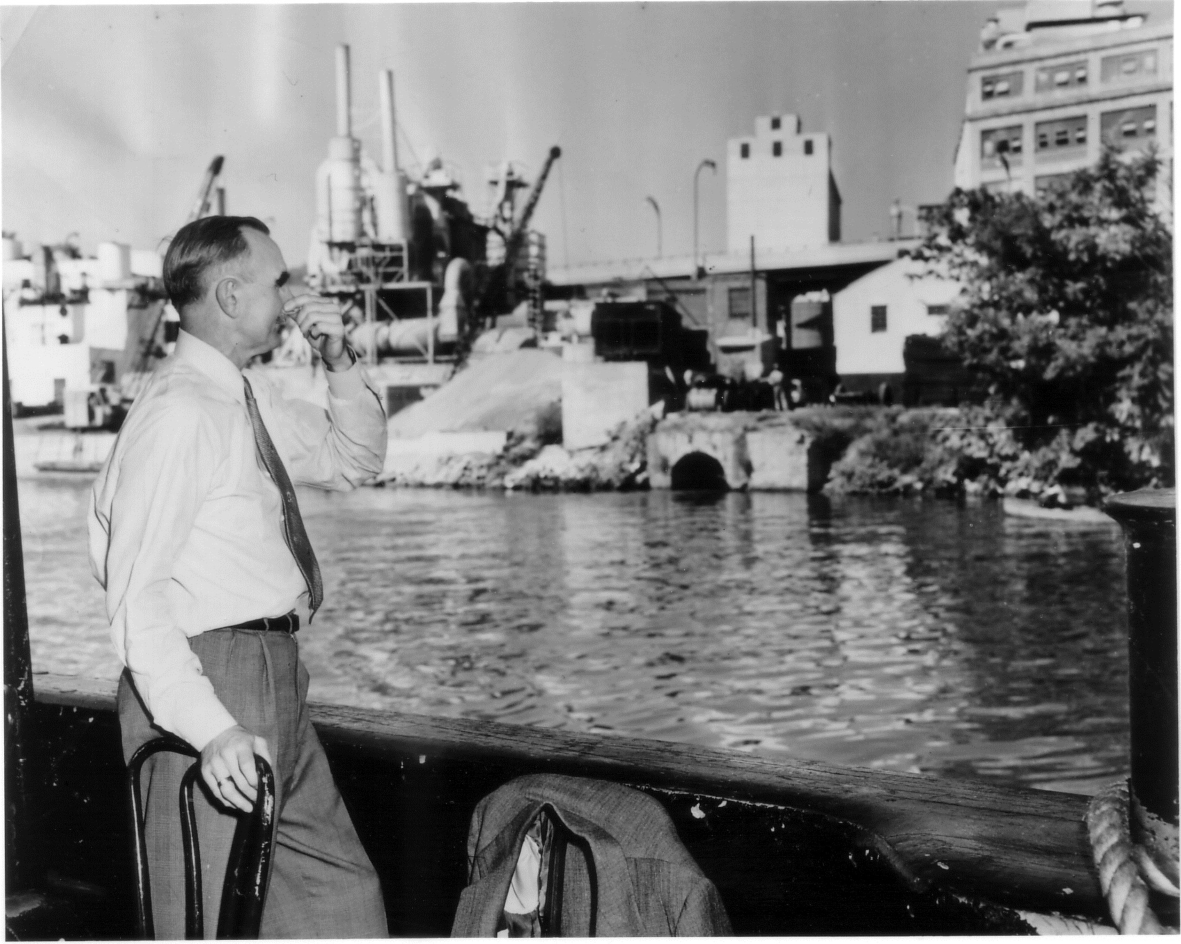
1953: Senator Wayne Morse holds his nose against the stench of the Potomac River near Georgetown. (ICPRB)

The 1950s opened with an ICPRB report that noted the entire river was unsafe for drinking, questionably safe for swimming upstream of Great Falls, questionably safe for recreation between Key Bridge and Haines Point, and the river downstream in the District was unsuitable for any purpose. A 1954 ICPRB report on DC-area water pollution helped inform a 1957 U.S. Public Health Service declaration that the Potomac in the District was “unsafe for swimming.” The report and pronouncement were important in leveraging authorization of public works and sewerage expansion that would begin to address the sewage problem.

In the 1960s, swimming and eating fish caught from river shore remained illegal, but the public continued to look toward the river. Lady Bird Johnson donated an elegant floating fountain that shot high up into the air in the Potomac River. During high winds the fountain was turned off due to fears the spray would douse the National Airport with cholera germs. The fountain was eventually deemed a public health hazard for spraying high levels of coliform bacteria onto the nearby park. Events like these increased public consciousness and activity. The decade saw the federal Water Pollution Control Act, Rachel Carson’s “Silent Spring,” and growing stewardship. Both federal and local laws were pushing for greater water quality.

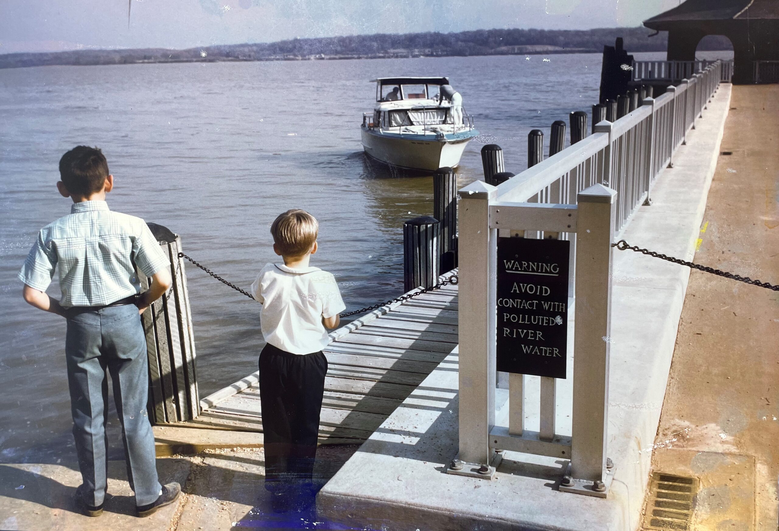
Photo Credit: Mount Vernon (ICPRB)

The 1970s saw continuing improvements to water quality in the metropolitan area and nationwide with the passing of the Clean Water Act and later amendments. The act guided federal money and restoration efforts, primarily in improved sewage treatment. The era saw increased public interest and pressure for better water quality. Residents of the District wanted to be close to the river in ways that were still in practice both upstream and downstream. Yet, D.C. water quality, including huge annual mats of blue green algae, resulted in a water contact prohibition by the D.C. Council in 1971. The growing public interest in a healthier environment in the 1970s kept the pressure on to clean up metropolitan waters. Riverfront signage in D.C. and down to Mount Vernon warned people to avoid contact with the water and to wash pets that came in contact with it.

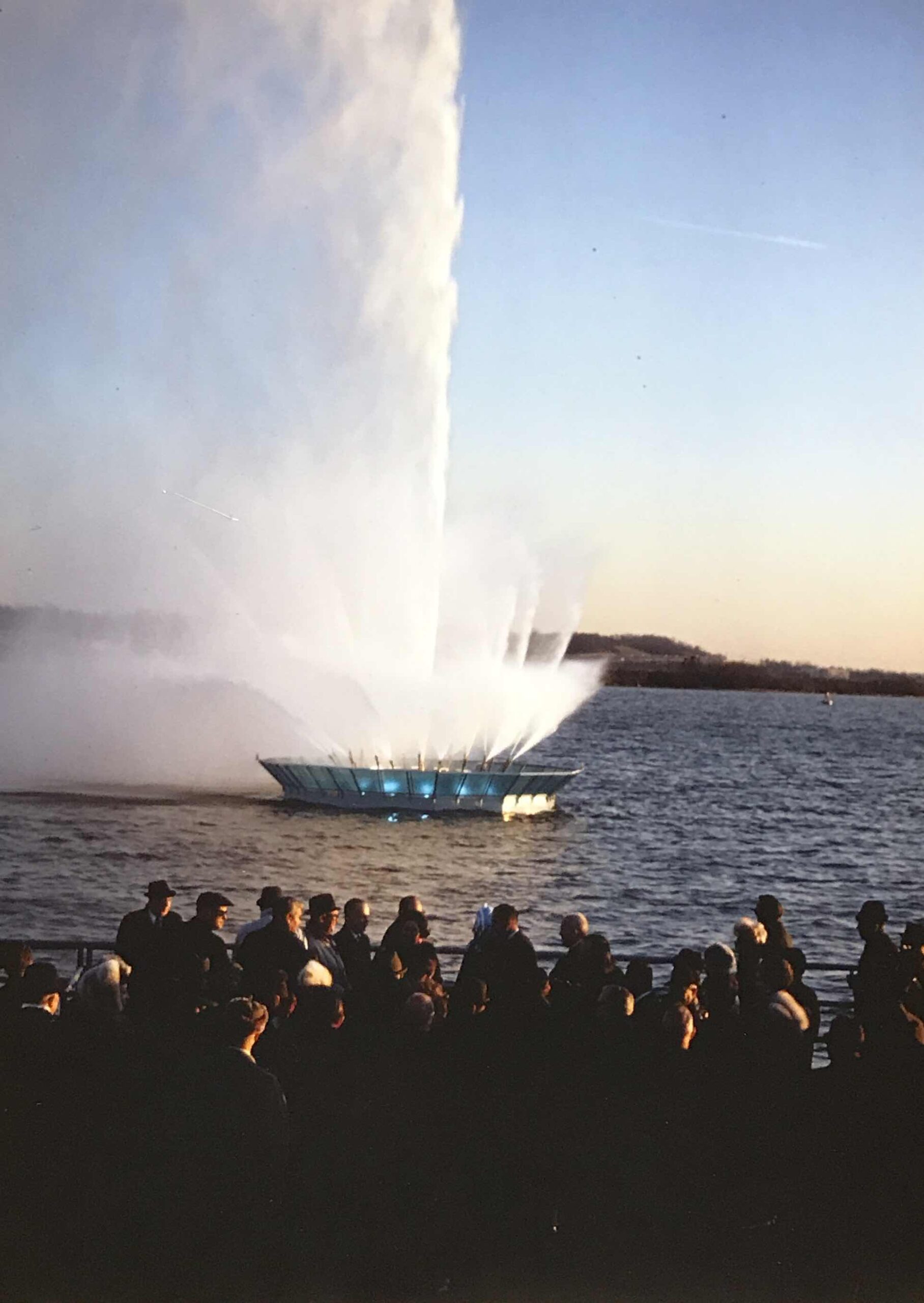
Lady Bird Johnson’s Potomac River fountain that was eventually deemed a public health hazard. (ICPRB)

Yet, there was hope. Annual algal mats declined during much of the decade, and largemouth bass returned to the river along with the return of bass guides who targeted D.C. waters.

Citizen interest in the river and the waterfront continued to build in the 1980s. The interest in the river’s health grew alongside interest in revitalizing the metro waterfronts and improved access. The effort was boosted by a National Marine Fisheries Service report on waterfront revitalization. The ICPRB, along with several federal agencies and some waterfront businesses formed the Washington Area Waterfront Action Group (WAWAG). The ad hoc organization sought to leverage revitalization interest along government-controlled land and sought ways to create a better public experience along the waterfront.

The WAWAG worked to transform the moribund Washington waterfront in many aspects. One was a task force to address swimming and other water contact recreation. The group held a press conference on bathing beaches and created a list of possible sites for bathing beaches along the metro river. The group’s efforts helped inspire other efforts.  Windsurfers in the District were angered that the boards were considered water contact, and so they held a press conference in which a number of windsurfers dressed in business suits and brought attaché cases aboard. This televised water rally proved that windsurfing was not necessarily a water contact sport, similar to canoeing and kayaking. A 1982 WAWAG report offered suggestion for potential “bathing areas” in the District.

Map of possible bathing beaches from WAWAG report.

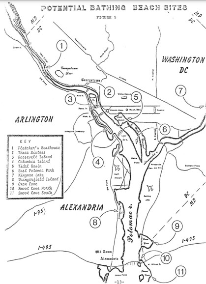
Potential swimming sites shown in WAWAG’s report.

The beginning of the Potomac Riverfests in D.C., and similar efforts in Alexandria and other communities became annual affairs.

Rambling Raft festivals were begun in D.C. Unfortunately, a resurgence in summer algae blooms and other considerations halted some of these events.

The wave created by WAWAG and other groups continued to grow, and demand for swimming remained an issue. In the early 2000s, ICPRB was approached by the Nation’s Triathlon, which was creating an event in D.C. The ICPRB helped direct them to the proper officials in D.C. government to get a permit for a swimming section off the National Mall. The permit required them to monitor the water for a month before the event to ensure acceptable water quality. The swim portion was cancelled several times during the event’s several years of running due to the stringent water quality requirement.

Map of possible bathing beaches from PRK report.

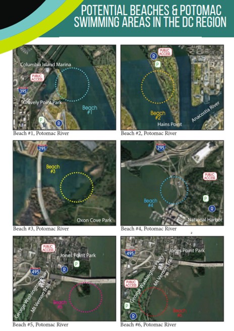
Potomac Riverkeeper Network’s Swimmable Potomac Report 2022

Now, Potomac Riverkeeper Network (PRN), Anacostia Riverkeeper, and other groups conduct weekly water quality monitoring to promote swimming and river recreation. Many of the test sites get the swimming “thumbs up” when the data is published at www.theswimguide.org. Just like the WAWAG report in the 1980s, the recent report published by PRN, Swimmable Potomac Report 2022, proposed several areas for public beaches in the future.

As the health of the river has improved over the eight decades since ICPRB was created, ICPRB has worked alongside government agencies, nongovernmental organizations, and the public to increase access and stewardship to our Nation’s River. We look forward to seeing D.C. residents and visitors take a cooling dip in the river on a hot summer day. As Lord David Attenborough says, “No one will protect what they don’t care about; and no one will care about what they have never experienced.”

  • Two women play leapfrog in old fashioned bathing suits along the tidal basin / Potomac River.
    Photo credit: Library of Congress
Entry Thumbnail

Registration Open for 2022 PFAS Conference

Register today for the 2022 Potomac River Conference: A Conversation on PFAS on September 22, 2022.

Join the Interstate Commission on the Potomac River Basin for a virtual conference on the state of the science, policy, technology, and the future of PFAS in the Potomac River basin. See the full agenda on our Events page or register here.

REGISTER HERE


Entry Thumbnail

About the Basin: Burke Lake Park

Burke Lake Park

7315 Ox Road, Fairfax Station, Virginia

Burke Park Lake at sunset.

Photo Credit: Burke Lake Park by Martin Chen (Flickr)

Are you a golfer? A train enthusiast? Are you into volleyball? Fishing? Or maybe orienteering is your thing. Whatever it is, Burke Lake Park has you covered. This 888-acre park in Fairfax Station, Virginia boasts a variety of activities for all interests, ages, and abilities. Just visit for the day or stay overnight at the Burke Lake campground.

Burke Lake has a 4.7-mile scenic trail along its shoreline that is perfect for bikers, hikers, and walkers. It was voted one of the top best fitness trails in the nation by American Hiking Society.

Bring your boat or rent one to get out on the lake. They have fishing kayaks, canoes, or electric motorboats available on a first-come, first-served basis. The lake is known for the strong largemouth bass population so don’t forget your fishing pole.

Kids and adults adore riding the Miniature Central Specific Huntington Steam Engine. A $5 ticket gets you a 10-minute ride through the woods on the mini-train.  After your train ride, head over to the carousel for some old-fashioned fun.

Amenities at the Park will provide a sporting-good time. There are three types of golf—mini-, regular-sized, and frisbee golf—plus, a driving range to practice your swing. You can feel the sand beneath your feet as you spike a ball on their volleyball courts.

Adventurers can try their hand at orienteering, a navigational sport that uses a map and compass. There are three different maps to choose from: beginner, intermediate, and advanced. Geocaching sites are located throughout the park as well.

Join Park staff for one of the many interesting classes and activities, like Twilight by Kayak, Campfire Cooking, and Birdwatching for Beginners.

Visit the Burke Lake Information Center for orienteering maps, frisbee golf score cards, and more information on ways to enjoy your visit to the Park.

Don’t forget to wrap-up the fun day with a hand-dipped scoop at the Burke Lake Park ice cream parlor.

Entry Thumbnail

About the Basin: G. Richard Thompson Wildlife Management Area

Thompson Wildlife Management Area

July 15, 2022

Markham, VA

Thompson WMA forest with a carpet of large-flowered trillium flowers.

Photo credit: Judy Gallagher, Large-flowered Trillium – Trillium grandiflorum, G.R. Thompson Wildlife Management Area, Linden, Virginia (Flickr)

Richard Thompson Wildlife Management Area, or Thompson WMA for short, is a gem of a recreational area in northwestern Fauquier County, Virginia. It is close enough for a day trip from the DC Metro area but far enough to make it feel a world away.

The highlight of Thompson WMA is the abundance of large-flowered trillium in the spring. Each spring, around Mother’s Day, the forest floor is carpeted with these showy, colorful flowers for as far as the eye can see. It’s not just the flowers that put on a show. The birds are in competition with the trillium for Best in Show. The stunning colors of birds like the cerulean warbler and scarlet tanager mix with the sights and sounds of a plethora of migrating and residential birds, creating a bird-watchers paradise. A Virginia Department of Wildlife Resource video, Trillium Bloom at Thompson WMA, shares some of the treasures you can find on a spring morning.

The Appalachian Trail runs through Thompson WMA along the crest of the Blue Ridge mountains. Various trails branch off the Appalachian, creating a network of rugged, but rewarding, hiking trails. The trails are multi-use, including equestrians, so don’t be surprised if you come upon a horse or two.

Dress in your finest orange attire during hunting season since this is a popular area for hunters. Deer are the most sought after, but turkey, woodcock, grouse, and other small game are possibilities.

Wildlife management areas are managed for wildlife and humans get the benefit. But that also means that there are few amenities, trails can be rugged, and roads can be rutted. Plan accordingly.

There are 11 designated parking areas throughout the WMA. Cell reception is spotty, so if you plan to meet a friend, make sure to agree on a specific parking area in advance.

Please make sure to follow the permitting requirements when utilizing public land. Anyone over the age of 17 requires an access permit to visit a Virginia Department of Wildlife Resources-owned wildlife management area. Hunting and fishing licenses are required for their respective activities. Additionally, there are special permitting requirements for camping in Virginia’s wildlife management areas.

Entry Thumbnail

ICPRB’s Fishing Report – July 15, 2022

Fishing News

Striped Bass Closure

The striped bass fishery on the tidal Potomac mainstem is closed until August 21. All Maryland areas of the Chesapeake Bay and its tidal tributaries, including on the Potomac, will be closed to any targeting of striped bass – including catch-and-release and charter boats–through July 31. This conservation measure was enacted because hot weather and low oxygen this time of year creates tough conditions for striped bass to survive catch and release – and this high mortality impacts the future of our fishery.

Fishing Report

The Shenandoah system is fishing well and recent storms have provided a small boost to the summertime flows. A mix of smallmouth bass, sunfish and channel catfish are being caught. The water is clear and both the North and South forks are fishable. Water clarity is good, and temperatures are near 80 degrees. Early morning and sunset are produce some nice topwater bites. The mountain trout streams are warming with some hatches occurring.

Anglers on the South Branch Potomac are finding some nice smallmouth in the low, clear water. The sector around Petersburg is popular.

The North Branch Potomac and Savage rivers continue to produce rainbow and brown trout in the management areas. The ICPRB is working with Maryland and other stakeholders to assess water temperatures and looking at how management can be improved to provide better conditions for the cold water fishery.

The upper Potomac River is running low and fairly clear with some stain. Water temperatures are near 80 degrees. The river continues to fish very well this season, and good catches can be had from the mouth of the Monocacy River to Point of Rocks. The downstream edge of the water stargrass at point of Rocks is worth a try, and the river down to Brunswick is productive in areas with rock gardens, fallen trees, and other structure that hold fish. Small plastics fished slowly in the rocks will find fish, often more than one from a given target. Long casts and finesse with the hook set go a long way toward landing a nice smallmouth bass. Channel catfish and large flathead catfish can be taken with lures or cut bait. There is always a chance for an elusive musky. An angler recently reported catching a northern snakehead downstream of Dam 4, and may be a sign of a growing population in the river. Snakeheads have been living in the watered parts of the C&O canal for some time.

In the metro area, temperatures are in the mid-80s with fairly clear water. Largemouth bass are being taken upstream of Key Bridge. In the District, anglers drawn to sparse grass beds. The Pentagon lagoon and Washington Channel are holding bass. Bridge pilings and docks are being targeted with crank baits and soft plastics near the pilings. The lower Anacostia is giving up some bass and snakeheads. The spoils area and docks at National Harbor are worth a try.

The tidal Potomac is seeing clear water and temperatures in the mid-80s. The Mount Vernon, Dogue Creek, and Little Hunting creek are less crowded than the downstream areas with established grass beds. Docks and underwater structure are holding largemouth bass, The heads of tidal creeks with grass are giving up nice snakeheads. The extensive grass beds in Mattawoman. Chickamuxen, and Aquia creeks are good but busy areas. Anglers are using chatterbaits, soft plastics, and other jigs on moving tides. Floating frog lures can bring exciting bites when dragged over the grass beds. Blue catfish will take cut bait most anywhere, but especially the channel edges off Fort Washington.

Fishing activity around the Colonial Beach area has slowed with the closure of the striped bass fishery.  Water temperatures are in the mid-80s with fairly clear water. Anglers are finding small croaker, spot, and white perch. Spanish mackerel are coming into the area. Blue catfish are not hard to find.. The slowly increasing salinity from dryer weather is bringing in some sea nettles, and there are a lot of dolphins to watch.

Near the river’s mouth, anglers are finding nice white perch. Croaker and spot are becoming more plentiful. Some speckled trout and red drum are being taken. Anglers are finding some, nice cobia off Smith Point. Some are using cut bait to get cobia, but that also invites bites from cownose rays. Spanish mackerel are being taken by trolling. And when the bite is poor for some species, the ubiquitous blue catfish will usually cooperate. Crabbing has improved with the heat and dry weather.

We are grateful to the many river watchers who contribute to this effort. Particular thanks go to the state departments of natural resources, National Bass Guides, Shallow Water Fishing Adventures, and  Machodoc Creek Marina, Inc.

Entry Thumbnail

About the Basin: Nathaniel Mountain Wildlife Management Area

Nathaniel Mountain Wildlife Management Area

July 8, 2022

Romney, West Virginia

A wildlife management area (WMA) is land owned by the state that is designed to conserve and manage high quality wildlife habitat. Public access is allowed and encouraged, but the amenities at WMAs tend to be more rustic than your typical state park. Nathaniel Mountain Wildlife Management Area is no exception. The roads can be rutted, and the camp sites are primitive, but a trip to Nathaniel Mountain WMA will reward you with the opulent sights and sounds of the wild.

A river with forested mountains on each side. Mill Run at Nathaniel Mountain WMA.

Photo credit: WVTourism.com

The mountain range, comprised of Big, Piney, and Nathaniel mountains, is the native home to the people of the Massawomeck and Shawandasse Tula tribes. It crosses Hardy and Hampshire counties, just south of Romney, West Virginia.

As the largest, and considered the most important, WMA in the state, the land provides vital habitat for squirrels, foxes, deer, bobcats, bears and many other species. Hunting, trapping, and fishing are popular activities on the 10,675-acre property.

Mill Run, a tributary to the South Branch Potomac River, is one of the larger streams within the WMA and is a popular fishing spot.

There are hiking trails throughout the area, but they may not be well-marked so have a map handy for navigation. For the 4.5-mile (roundtrip) hike to the historic fire tower, park at the base of Mill Run Road. Built in 1939, the watch tower provides an impressive piece of firefighting history (climbing the tower is not permitted).

Grab one of the 75 primitive camping sites (with pit toilets) for a fully immersive experience in nature.

For hiking, camping, fishing, and hunting, the Nathaniel Mountain Wildlife Management Area is the embodiment of West Virginia state’s motto, Wild and Wonderful.

Entry Thumbnail

ICPRB’s Fishing Report – July 8, 2022

Some Fishing News…

Striped Bass Closure
Boy fishing at sunset. Large river in the background.The striped bass fishery on the tidal Potomac River proper is closed to striped bass fishing until August 21 and the Maryland embayments will close on July 16, reopening on August 1.

Smallmouth Stocking
The Maryland Department of Natural Resources recently began stocking smallmouth bass fry that have been raised from adult fish that were spawned at the Joseph Manning Hatchery in Cedarville this spring. These supplemental stockings help smallmouth bass populations in the upper Potomac.  On June 14 crews stocked a total of 15,000 smallmouth bass fingerlings (two to three inches) in the upper Potomac River at Taylors Landing, Snyder’s Landing, Shepherdstown, and Dargan Bend boat ramps. On June 29 an additional 15,000 smallmouth bass fingerlings were stocked at Brunswick, Point of Rocks, Noland’s Ferry, Whites Ferry, and Edwards Ferry boat ramps. The effort is a response to decreased reproduction from previous years.

Potomac Dolphins
The Potomac dolphins have returned for the summer and seem to be traveling up the river in force. A large pod of the marine mammals (estimated roughly to 50-80 individuals) was seen near the Route 301 Bridge and Machodoc Creek. Spreading some angler hearsay, some have noticed that schools of baitfish and stripers seem to disappear in the presence of the pod and see the dolphins as competitors for fish. Anglers can share their observations with the Potomac-Chesapeake Dolphin Project.

Maryland is considering some changes to fishing regulations. Public comment is invited.

Fishing Reports

The Shenandoah system is pleasing anglers with good catches of smallmouth bass, sunfish and channel catfish. The water is clear and both the North and South forks are fishable. Water clarity is good, and temperatures near 80 degrees are making the low, lazy waters productive. Early morning and sunset are producing some nice topwater bites. The mountain trout streams are warming with some hatches occurring.
.
Anglers on the South Branch Potomac continue to find some nice smallmouth bass, especially in deeper holes Good reports are coming from the Petersburg area.

The North Branch Potomac and Savage rivers continue to produce rainbow and brown trout. Trout management areas are producing, and nice catches are being reported. The trout are fewer in the downstream reaches where temperatures are rising.  Most of the action is upstream of Pinto.

The upper Potomac River is continuing a nice summer season. The river is in its low summertime mode and canoes and kayaks will have a navigational advantage over powerboats.  This is also a good time for wading. The sector from Point of Rocks down to Brunswick is particularly good. Early morning and evening deliver nice topwater opportunities. During the day, find large structure where fish are concentrated. Anglers are using small soft plastics to probe rock gardens, boulders, and wood structure. A slow retrieve is favored, and the bite can be light. The fairly clear water favors long casts that won’t spook the bass. The Monocacy River is fishing well, although local storms may muddy the water. Smallmouth bass sunfish, and channel and flathead catfish are all biting.

In the metro area, largemouth bass are in the summer mode as water temperatures climb into the mid-80s. The sparse grass beds in this region have anglers targeting bridge pilings in the District of Columbia, where anglers are using plastics, buzzbaits, and crankbaits to probe waters with visibility of a couple of feet. Largemouth, smallmouth and striped bass can be found. The Pentagon lagoon is giving up some largemouth bass. The seawall in Washington channel is always worth a try along with the grass bed. Hard structure in the lower Anacostia are targets for bass and some snakeheads. Anglers are probing the spoils are aby Wilson Bridge with soft plastics and buzzbaits, and the piers at National Harbor are productive on a moving tide. Blue catfish can be caught in most areas with cut bait.

In the tidal Potomac, anglers are targeting hard structure and the few grass beds. Hydrilla patches are emerging, providing some fish cover worth exploring. Anglers are targeting docks and wood structure on moving tides with a variety of soft plastic and crankbaits. The 80-plus-degree water is carrying some stain. The visibility of about two feet improves near any grass beds. Anglers are finding bass in the tidal cuts at Belle Haven. Blue catfish are everywhere, but the channel off Fort Washington is a honey hole that regularly turns up fish of 40 pounds or more. Mattawoman Creek is always worth a look, although the grass beds and lily pads are a very popular spot. The larger grass beds in creeks downstream become the primary target for largemouth bass. And snakeheads. Pohick Bay, Aquia Creek, and Dogue Creek have nice beds of grass worth targeting. Snakehead fishing is very active at the heads of tidal creeks with grass beds in shallow water. Floating a frog lure over the beds on a moving tide can produce some great topwater strikes. Anglers are using strong braided line to get the fish out of the grass beds, where anglers also are using ploppers and crankbaits at bed edges.

Anglers in the Colonial Beach area have seen angling slow a bit. Anglers are finding small croaker, spot, and white perch. Blue catfish are not hard to find. Water temperatures are in the low 80s, with some green stain and mud near creek mouths after storms. The slowly increasing salinity from dryer weather is bringing in some sea nettles, and there are a lot of dolphins to watch.

Near the river’s mouth, anglers continue to report very good catches of stripers in the Maryland embayments and in the St. Mary’s River. The Potomac River proper is closed to striped bass fishing, and the Maryland embayments will close on July 16 (see above). Some cobia are being taken near Smith Point.  Some croaker and spot are being caught, along with white perch, which can be a lot of fun to catch on light tackle. A few red drum and small flounder in hard bottom areas round out the catch. Crabbing is improving a little but remains slow.

We are grateful to the many river watchers who contribute to this effort. Particular thanks go to the state departments of natural resources, National Bass Guides, Shallow Water Fishing Adventures, and  Machodoc Creek Marina, Inc.