Great Falls
September 3, 2021
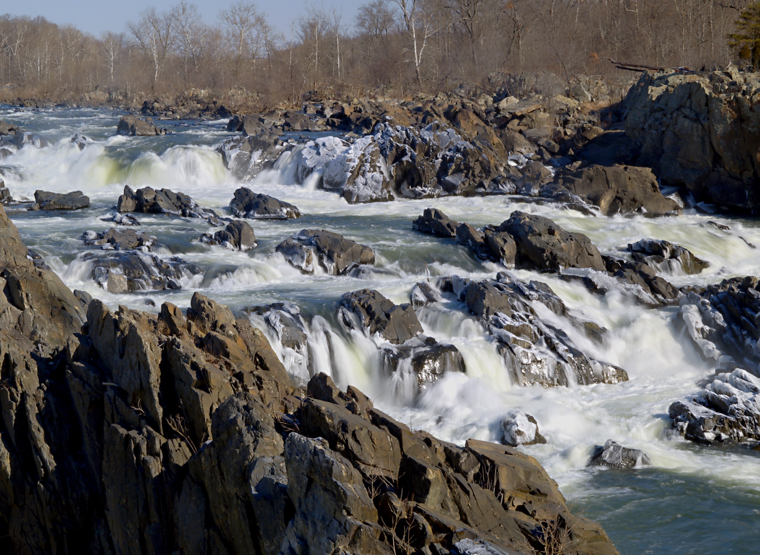
The dramatic rocky rapids of Great Falls provide the perfect background for yesterday’s history and today’s selfies. Two National Parks flank both sides of the Potomac at Great Falls: (1) Great Falls Park on the Virginia side; and (2) the C&O Canal National Historical Park on the Maryland side.
According to archaeological records, this area has been a meeting place for thousands of years. The Piscataway and Powhatan tribes used the area for trading missions from 8000-1700 BC. Much of the modern history of the area involves the boom-and-bust cycle of towns built around one industry: the construction of the canal. The ruins of one such town, Matildaville which was named after the mother of Robert E. Lee, are still visible today.
Starting in the early 1800s, city folk would venture up the river via a 6 to 8-hour boat ride to eat, dance, and spend a mere $.25 to stay the night at the lodge. A carousel, installed in 1906, was a big draw for the Great Falls Amusement Park. The amusement park closed in 1952 but the carousel stuck around until Hurricane Agnes blew through and destroyed it in 1972.
Today, getting to the falls is much more convenient. Whether accessed from the Virginia or Maryland side, the falls are possibly the most photographed section of the Potomac River. As one of the more popular parks in the area, the riverside retreat is still a popular meeting place and can get crowded on nice days. Both sides of the river have visitor’s center with maps and history of the area and picnic tables to enjoy an alfresco meal.
On the Maryland side, visitors can get a small taste of the history by taking a boat ride through the 8-foot rise of the canal while park attendants, dressed in period costumes, tell the story of the area.
The falls are a natural boundary between the navigable tidal Potomac below and the river’s freshwater mainstem above, thwarting those who travel by water. This holds true for both humans and aquatic species, as this area is the natural upstream boundary of the American shad migration.
The variety of hiking levels go from “Easy Stroll” to “Mountain Goat-Inspired.” If you are of the mountain goat-variety hiker, check out the 1.7-mile Section A of the Billy Goat Trail. Make sure to bring water, snacks, sunscreen, and a map, as the short distance can be deceivingly hard, especially on warm days.
The rapids are for admiring, not for swimming or wading. It is dangerous and illegal to swim anywhere in Great Falls. The 15-mile Potomac River Gorge can create unexpected treacherous conditions even for the most skilled swimmers and paddlers.
Always check Current Park Conditions before visiting the park as trails or other areas of interest could be closed.
Looking for someplace new to visit in the Potomac basin? The weekly About the Basin feature highlighting destinations (on our Facebook, Twitter, and Potomac River Watch) are now available on the Wandering the Watershed map. Readers can now choose a destination from our compiled list of basin gems. Visit regularly as new postings will be added. Enjoy your tour through the Potomac basin! The new feature also can be accessed through the maps page on our website.